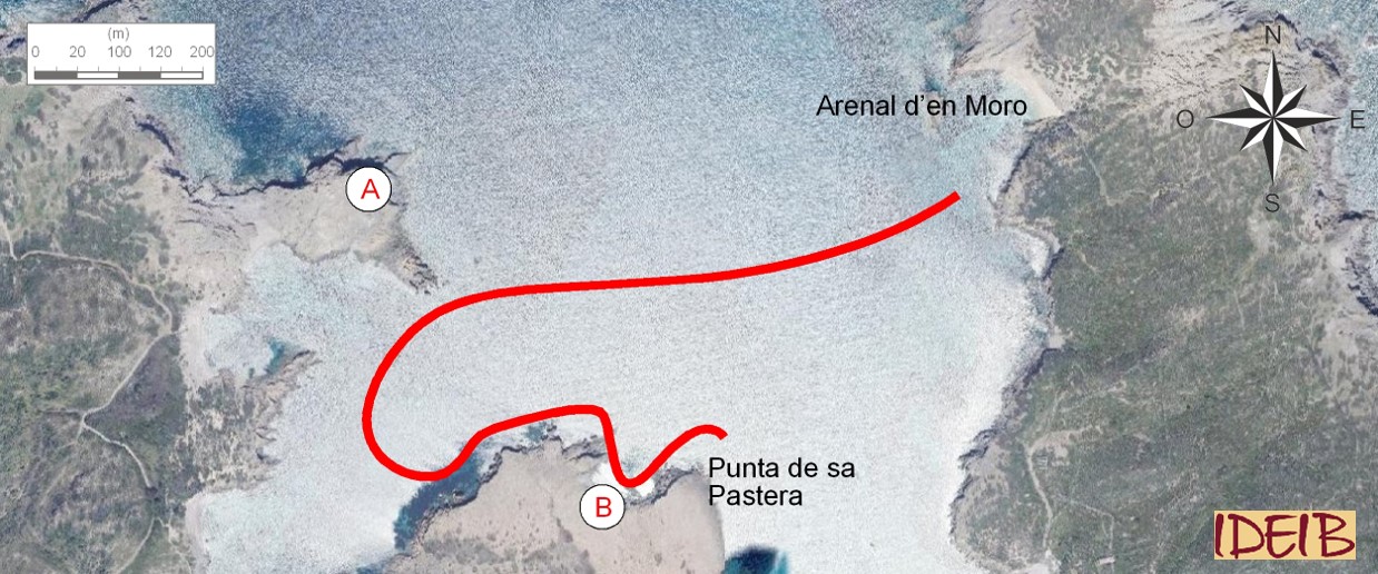
Proposed route to the stopping point.
Crossing the channel known as Es Pas that separates the islet from the parent island, which was opened up by the constant waves swept up by the Tramuntana wind, you can stop under the Sa Torreta o de Rambla coastal defence tower. This is a truncated cone-shaped tower built in the late eighteenth century from stone and mortar, which stands some 25 metres above sea level and that is constructed on three floors. These buildings are found the entire length of the island’s coast and their mission was as defence or watch towers against possible military invasion or attacks from the pirates that operated in the Mediterranean up to the eighteenth century. In Menorca, we know of fifteen defence towers, of which fourteen are still standing today in varying states of conservation. Unfortunately, this is one of the ones in the worst state, largely because of the stone used in its construction.
The raw material of these constructions is the stone from the land around them – it was almost never transported from elsewhere – which allows the perfect integration of the towers with their landscape. The bottom of the tower is made of dark blocks of sand-sized clasts.</p><p><br></p></div>">sandstone from the Paleozoic, a hard rock, as we have mentioned, that was used to build the lower part and the foundations of the tower and which is in a relatively good state of conservation. By contrast, the construction material used above this were rocks from the Quaternary, which are much softer, which means that they are much more manageable and easy to cut and work, but because of their low level of hardness and compacting, they are easily eroded, causing degradation especially to the top of the tower. It is interesting to note that this degradation is much more extensive on the south face than the one facing the north.
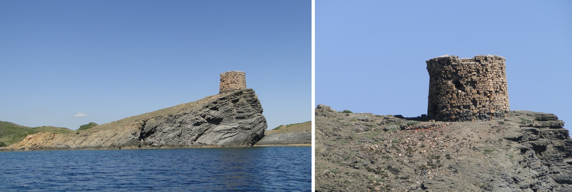
Sa Torreta o de Rambla defence tower with the lower part constructed from blocks of sandstone from the Paleozoic and the top part from marès from the Quaternary, which is rather degraded, especially on the south face of the tower. At its foot, you can see a lovely outcrop of layers of different thicknesses, inclined and eroded, of sandstones and lloselles from the Paleozoic (point A).
You can see rocks from the Quaternary on the southern side of the cove. Like the great majority of rocks formed during this period in Menorca, these were caused by the wind accumulating large amounts of sand near the coast, forming dunes. This great pile of sand was the consequence of successive climate changes that have affected the Earth over the last million years. During the extremely cold periods of glaciation, the water on Earth accumulated in the form of large glaciers at the geographical poles and on mountains, leading to a drop in sea level. During the last glaciation, the sea level in the Mediterranean was some 120 metres below the present level, which led to Mallorca and Menorca forming a single island. This process meant that huge extensions of sand, that were originally below the sea, were left to the mercy of the wind, which, if it blew from the sea inland, could drag the sand towards the coast creating a line of dunes, which, when it came up against an obstacle, such as a cliff, would deposit sand at the foot of it. Over the years, these sands have consolidated, forming a rock that is called marès.
In these rocks, specifically the block after the cliff separated from the shore known as Es Colomar, fossils of Myotragus have been identified, a mammal from the Caprinae subfamily. It is believed that this animal arrived in the Balearics at the end of the Miocene (around 5 million years ago) when a large part of the Mediterranean dried up. Isolated from the outside world and free from predators, its evolution resulted in the rather curious-looking species known as Myotragus balearicus, small in stature, with very short robust legs, very centrally positioned eyes and just one incisor. It is thought that the first Menorcans lived alongside the last populations of Myotragus, directly or indirectly leading to their extinction. In fact, the only species of vertebrates that survived the beginning of human occupation of the island was the Balearic gecko.
If you carry on along the coastline towards Es Grau, you will see the contact between the marès of the Quaternary and the alternations of sandstones and sedimentary rock which tends to exfoliate in small flakes, similar to sedimentary rock formed by clay.</p></div>">pelite. </p></div>">llosella from the Paleozoic. The sandstones are sliced through at the top by the marès as though it were a sash. You have to imagine that a great and intense erosion wiped out a large amount of sedimented materials during the time that elapsed between the sedimentation of these rocks (over 300 million years), so allowing the two rocks formed in such different times in the Earth’s history to be found together. Note that the sandstones are inclined as a result of the action of large tectonic movements and that, as though it were a knife, erosion has enabled the horizontal sedimentation of the Quaternary materials on top. At this point, you will see abundant parallel lines in the marès, going in different directions, that indicate variations in the movement of the wind and, therefore, of the layout of the grains of sand.
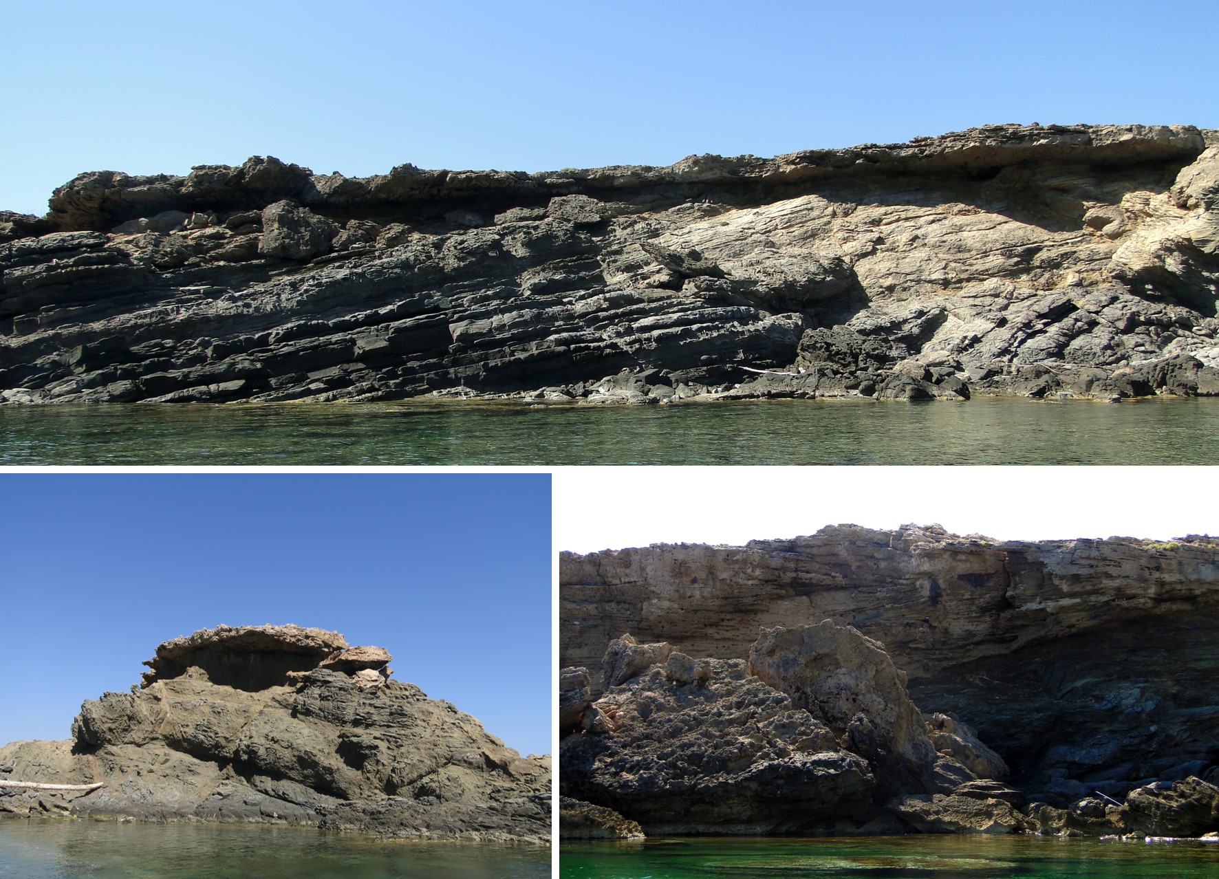
In a corner just before you get to the Punta de sa Pastera headland, you can see the contact between the rocks of the Paleozoic inclined by tectonic movements and the marès from the Quaternary sedimented by the action of the wind. These latter are placed on top of the former ones in a wedge shape, thinning towards the southwest, which allows us to identify that the predominant wind that dragged the sand inland came from the northeast. The fine lines shown by the rock are a reflection of the successive accumulations of sand by the wind (point B).
When you reach this point, you can choose to go back to Es Grau or carry on with the trail heading for Addaia. Stopping Point 4 is designed as a transition stop between the two areas where the interest of the trail is concentrated.