Suggested route to the stopping point.
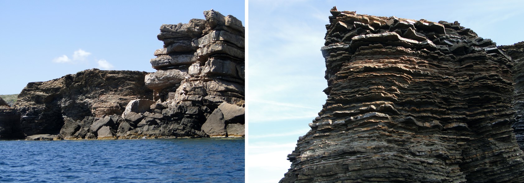
The name of Els Armaris (The Cupboards) is a clear reference to the geology of the site. The cliff is made up of alternating layers of sandstones and sedimentary rock which tends to exfoliate in small flakes, similar to sedimentary rock formed by clay.</p></div>">pelite. </p></div>">llosella, and as the latter are softer, they are much more eroded than the sandstones. This way, the succession of rocks standing proud (the sandstones) and rocks that go inwards (the sedimentary rock which tends to exfoliate in small flakes, similar to sedimentary rock formed by clay.</p></div>">pelite. </p></div>">llosella) recall the image of giant shelves. If you look closely, you will see that the rock is slightly different from the sandstones and lloselles that you have seen in the rest of the trail, they have other colours, the layers are more rounded, etc. This is due to the fact that despite being the same type of rock (sandstones and lloselles) and being formed the same way (through turbulent currents, giving rise to turbidites), here the rocks are older, having been formed 100 million years before the rocks in the south of the stopping point. The rocks you see in front of you are an example of the oldest rocks in the Balearic Islands.
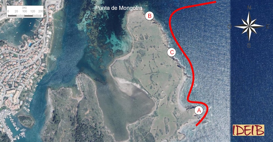
Consequently, the Paleozoic series shows stunning outcrops of alternations of sand-sized clasts.</p><p><br></p></div>">sandstone and lloselles in the area around Els Armaris. Note that the size of the sandstones is quite different in the proximities of Cala en Brut compared with the Els Armaris area. As you head for the Punta de Mongofra headland, you will see thicker strata, the result of the grain of sand forming it being coarser. This fact must be linked to the sedimentation of these rocks. The thick strata are proximal stratigraphic unit and reflect the specific environmental conditions in which they were formed.</p><p><br></p></div>">facies, in other words, as the sediments deposited in the proximities of the talus were coarse and heavy grains of sand, they sedimented just as they reached the sea depths. By contrast, the finer grains were kept in suspension longer and were able to get further away from the base of the talus. Therefore, the alternations of sandstones and lloselles that you can see near Cala en Brut are related to distal stratigraphic unit and reflect the specific environmental conditions in which they were formed.</p><p><br></p></div>">facies.
Alternations of sandstones and lloselles at Els Armaris. In the foreground are wide strata of sandstones, formed by coarse grains of sand, that were sedimented in the sea depths near the talus. Behind are thinner strata, with fine-grained sandstones that were sedimented further away. The photograph on the right shows a close-up of the appearance of these finer grained rocks (point A).
As they are older rocks, they are very deformed. We can identify in them the last two great phases of deformation of the Earth’s crust, which we know as ‘orogenies’. Orogenies correspond to the series of geological processes that acted over millions of years to lead to the creation of the Earth’s mountain ranges originating the relief. In the first of the last two orogenies identified in the history of the Earth, the Hercynian orogeny, the Paleozoic materials were plastic and consequently folded as this process embraces all the deformation movements in the Earth’s crust that occurred between the late Devonian (355 million years ago) and the late Paleozoic (250 million years ago).
Outstanding at Punta de Mongofra is an imposing toppled fold, a huge undulation of the rocks caused by being subjected to enormous compression forces, originating during these incredible Hercynian folds. Later, during the last orogeny to affect the Earth, the Alpine orogeny, which began in the late Cretaceous (65 million years ago) and which was at its height in the Cenozoic, specifically in the middle Miocene (15 million years ago), the Paleozoic materials were already rigid and so were broken instead of folded. Throughout the outcrops at Els Armaris you can see numerous faults, fractures that caused the displacement of the blocks affected, formed during the Alpine orogeny.
The Alpine orogeny caused the collision between two large tectonic plates: the African plate and the Eurasian plate, which were separated during the Mesozoic by a huge sea called ‘Tethis’, which covered a wide extent between Africa and Europe. As these two continents approached due to the effect of this orogeny, the sediments that had been formed over millions of years and accumulated at the bottom of the sea basins steadily transformed into rocks and compressed. As though it were a crash in slow motion, the immense force that these two continents drove caused the deformation of the sediments of the Mesozoic and oldest Cenozoic, which covered very many kilometres and, as has been explained, the breaking of the oldest and most rigid rocks of the Paleozoic and, in turn, the piling of some on top of the others.
This process culminated in the emergence of huge rocky masses from the seabed, creating the great mountain ranges that currently surround the western Mediterranean Sea such as the Italian Apennines, the Alps, the Pyrenees, the African Atlas Mountains and the Baetic Mountains, of which Menorca is the eastern tip. In other words, the great revolution caused by the configuration of the Alpine orogenous Earth was responsible for Menorca emerging from the depths of the sea and beginning a long journey to the make-up that we see today.
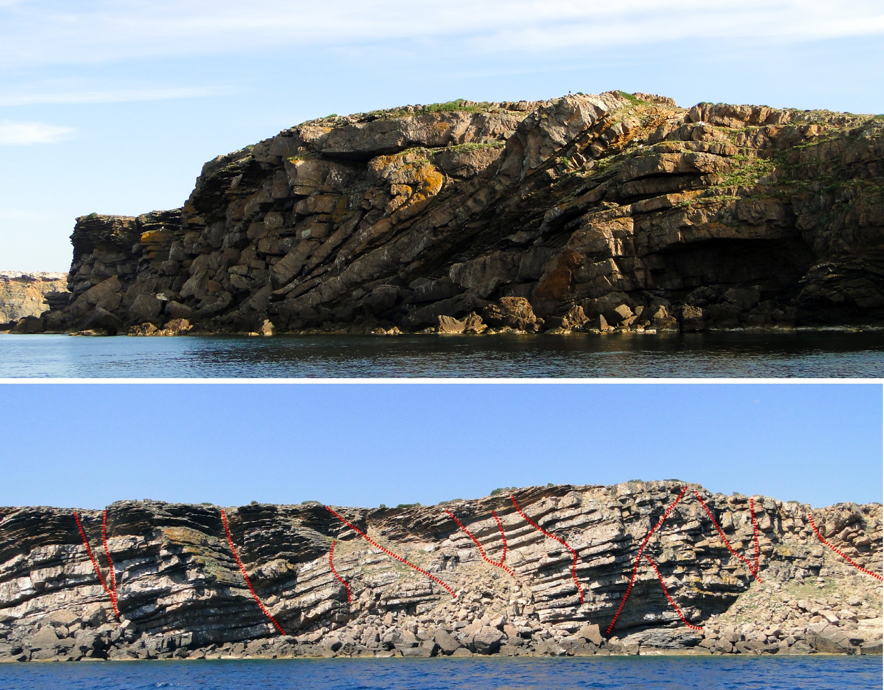
The rocks in the Els Armaris – Punta de Mongofra area were subjected to the last two immense mountain creation movements that have affected the Earth. In the first of these, the Hercynian orogeny, the rocks were still not fully consolidated and were folded, with spectacular examples such as the toppled fold at Punta de Mongofra (top, point B). Much later, during the Alpine orogeny, these rocks were hard, a fundamental factor in that instead of folding, they broke, with the appearance of numerous faults that displaced the blocks of rock with regard to others. The whole of the Els Armaris cliff is intensely affected by the action of these faults (bottom, point C, the line of the main faults is shown in red).