| UTM-X | UTM-Y | ||
|---|---|---|---|
| STOP 1: CALA PI | |||
| STOP 2: FACING THE TOWER OF CALA PI | |||
| STOP 3: CALA BELTRAN | |||
| STOP 4: ES BANCALS, SOUTH-EAST SECTOR | |||
| STOP 5: ES BANCALS, NORTH-WEST SECTOR |
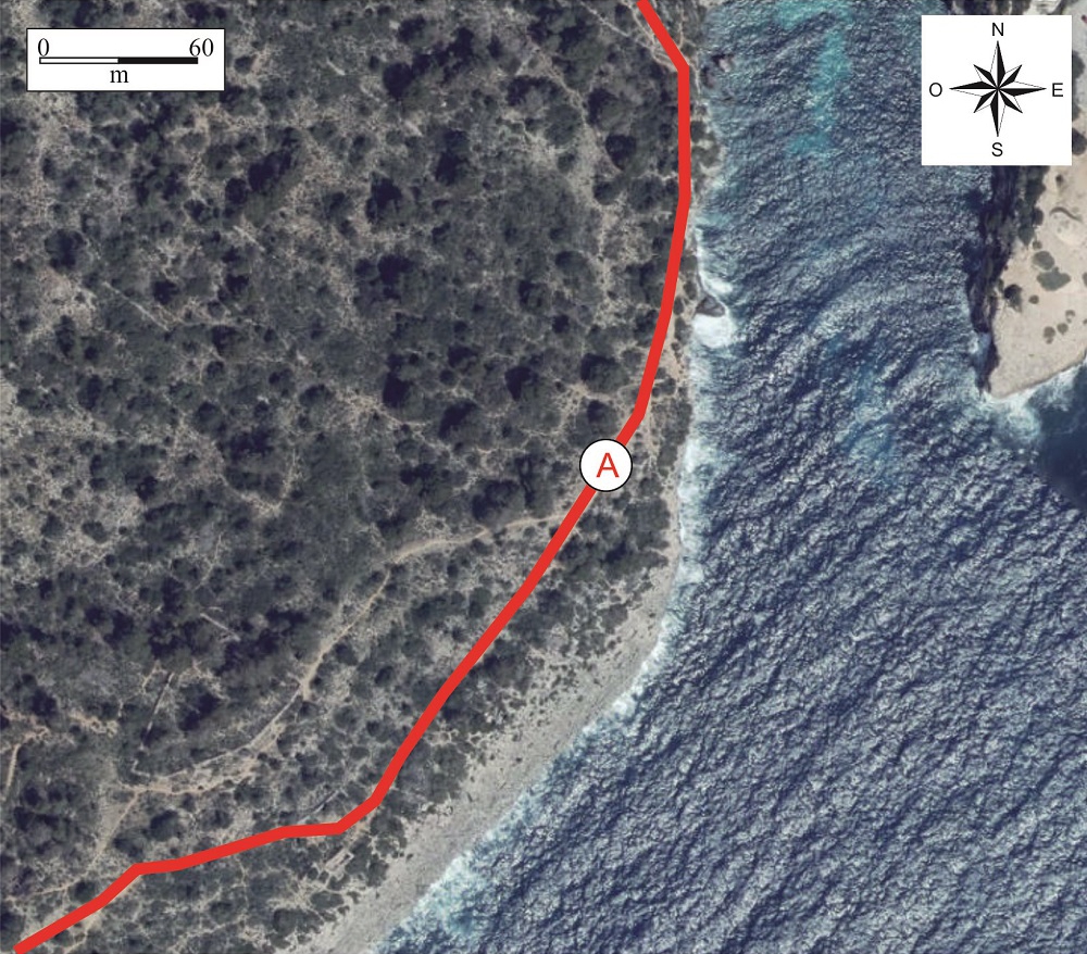
Recommended route.
Climbing the cliff on the other side of the torrent, we will walk parallel to it, until we are approximately facing the tower of Cala Pi. At this point there are remains of an ancient Pliocene beach.
The rocks we can see along the path and on the cliff top correspond to lumaquelas, rocks composed of countless small mollusc fragments. This type of rock was much appreciated in ancient times for making millstones.
Corresponds to the periods following the Messinian Salinity Crisis, when, after the desiccation of the Mediterranean, water from the Atlantic re-entered, some 5.3 Ma ago.
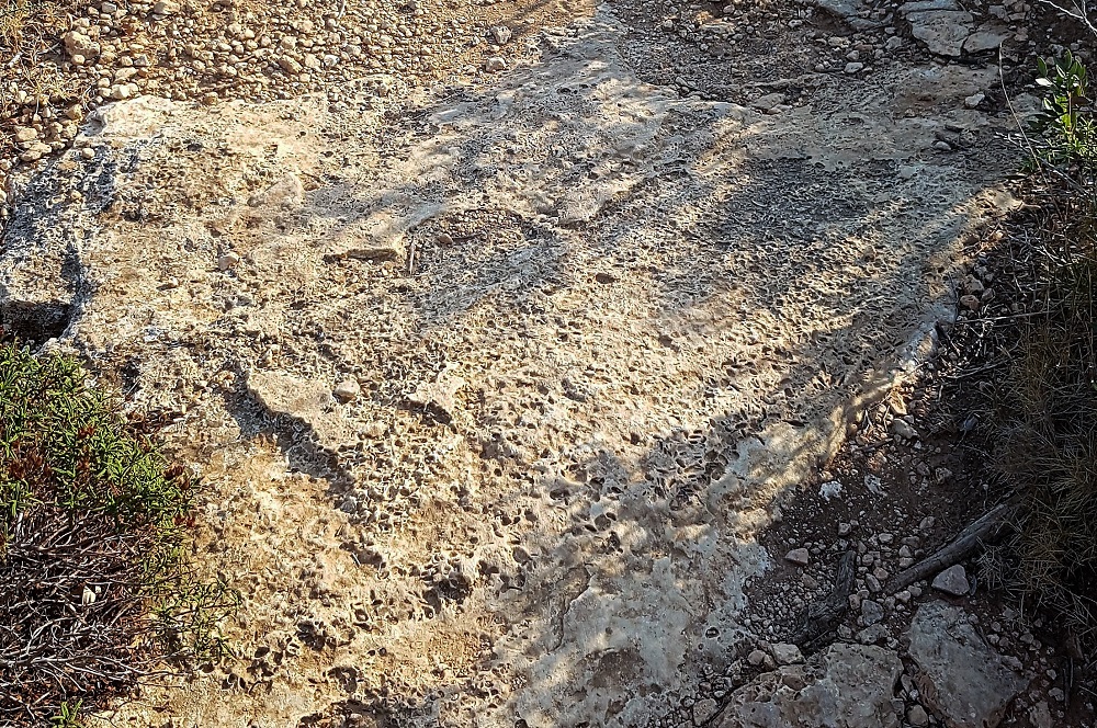
Detail of the Pliocene lumaquela on the path.
At that time the sea level was much higher than today, due to the climate being notably hotter.
Opposite this tectonic, eustatic or antropical processes</span></p></div>">outcrop we can see the tower of Cala Pi, built directly on the lumaquelas of the Pliocene and at the same altitude.
This indicates that at the moment the lumaquelas were deposited, the beaches were continuous and the cove we see today did not exist. The appearance of the coastline during the Pliocene must have been similar to that of the present-day sand beaches, without the great height differences of the cliffs we see today.
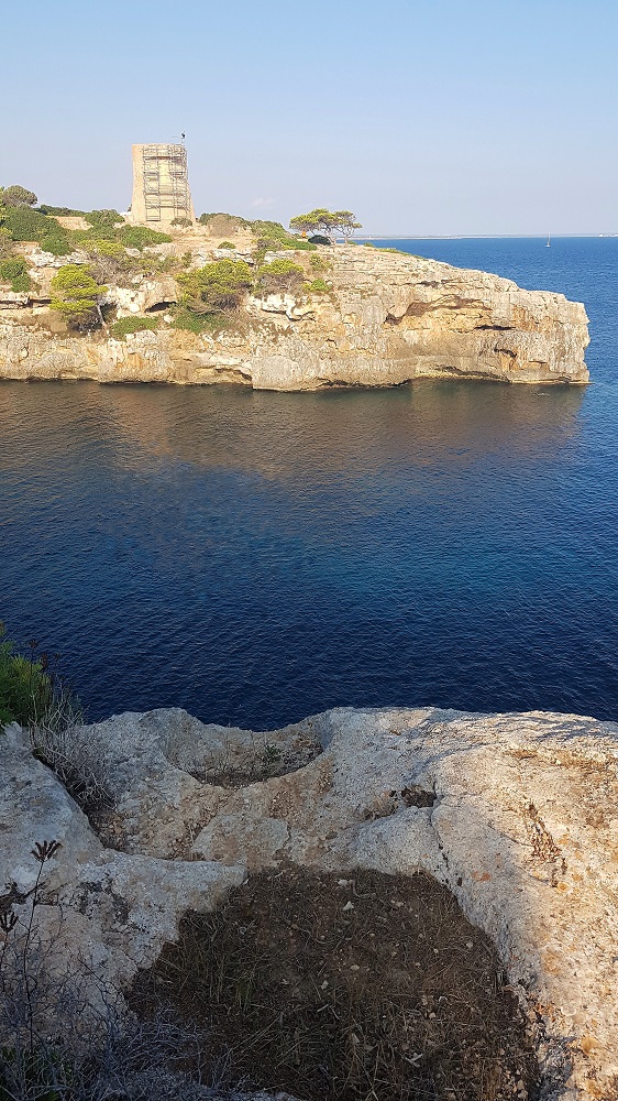
View of the tower of Cala Pi from the stop (point A). This building was erected over the Pliocene beach represented on both sides of the cove, which indicates that the coastline was continuous. In the foreground, marks of extraction of millstones.