| UTM-X | UTM-Y | ||
|---|---|---|---|
| STOP 1: CALA PI | |||
| STOP 2: FACING THE TOWER OF CALA PI | |||
| STOP 3: CALA BELTRAN | |||
| STOP 4: ES BANCALS, SOUTH-EAST SECTOR | |||
| STOP 5: ES BANCALS, NORTH-WEST SECTOR |
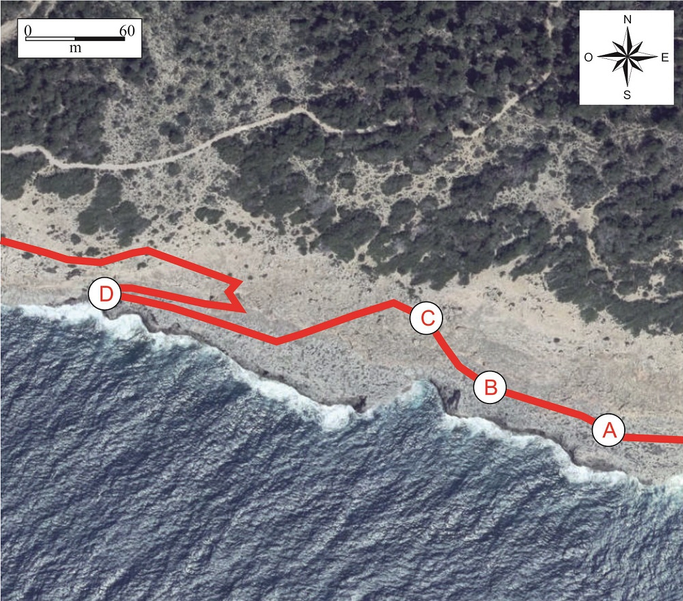
Recommended route.
Continuing in parallel with the coastline we can observe, within the Miocene reef limestones eroded by the Pliocene platform, a type of stratigraphic unit and reflect the specific environmental conditions in which they were formed.</p><p><br></p></div>">facies not seen until now.
It consists of limestones with rhodolites, accumulations of calcareous algae usually with rounded shapes and irregular texture.
Nowadays these structures are found in a multitude of marine environments, both cold and warm. Depending on the depth and the energy of the medium, the rhodolites tend to be more rounded (high energy) or more irregular (low energy).
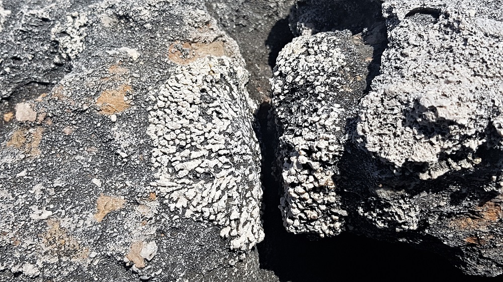
Sectioned rhodolite (point A).
In addition to their shape, their chemical composition is also valuable from a paleontological point of view, offering precise information about the environment and the climate at the moment of their formation.
Continuing along the route, and approaching the orangey-coloured strata of the Pliocene and Pleistocene, we can observe a deposit with marine fauna (point B). This is a paleontological site of the Middle Pleistocene formed largely by abundant examples of Patella ferruginea, the endemic giant limpet of the Mediterranean. Although today this species is in danger of extinction – in fact, in the Balearic Islands it is believed to have disappeared – it seems that during the Pleistocene it was very abundant. The matrix that contains the fossils is extremely hard and has a high percentage of red silts, which indicates that in spite of having fauna of marine origin its continental influence is evident
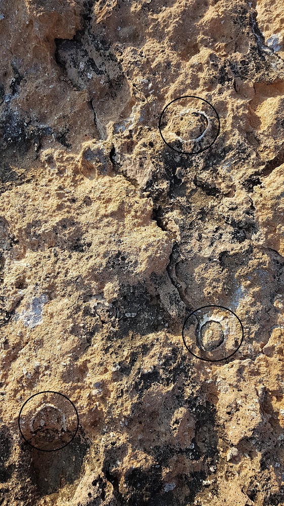
Fossils of Mediterranean giant limpets (Patella ferruginea) from the Middle Pleistocene on point B. The largest examples measure more than 80 mm.
The rest of the orangey-coloured strata correspond to an alternation of paleosols and dunes. Their arrangement is not random, since it is intimately related with the glaciations of the Pleistocene.
In this respect, the paleosols denote a moist, warm climate, with a relatively high sea level due to the melting of ice at the earth’s poles. In contrast, the dunes denote a cold climate with a sea level sufficiently low to uncover large extensions of sandy seabed, which being transported by the wind would form the dunes.
All these deposits described here are eroded, giving rise to a stepped morphology of the littoral slope, which is why this area is known as Es Bancals (“the terraces”).
Along the slope and at the highest part (point C) we find large isolated rocky blocks weighing several tons which at times appear to be aligned. Their lithology indicates that they originate from the formations described above, all located at a lower altitude.
Considering their large dimensions and their location, of at least 20 metres high, it is easy to deduce that they have been transported by one or more high-energy marine events.
The fact that the blocks are imbricated (lying on top of each other with a certain inclination) indicates that they were not dragged and thrown against the coastline in a chaotic manner, as could be expected in a sea storm, but were dragged and torn up by a current of water. This characteristic is typical of tsunamis.
Tsunamis, although infrequent in the Balearics, have been well documented in various zones of Formentera, Menorca and also Mallorca, by means of the study of these rocky blocks (called tsunamites).
The orientation displayed by the blocks indicates that the origin of the tsunamis was in Algeria, a zone of high seismic activity.
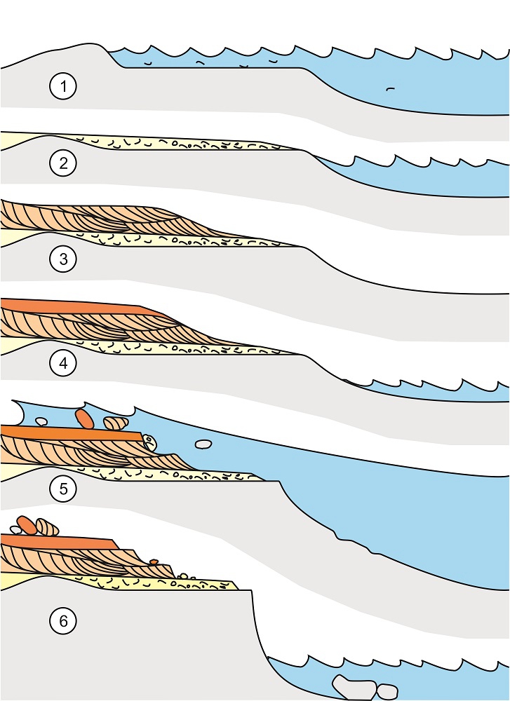
Idealised reconstruction of the formation of Es Bancals with the elements seen at this stop and the previous ones. 1) Formation of the abrasion platform. 2) Deposition of the lumaquela. 3) Deposition of dunes. 4) Deposition of paleosols. 5) Tsunami. 6) Present-day appearance.
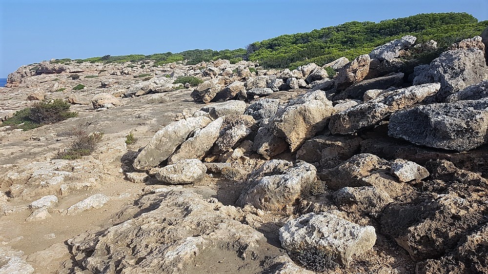
Tsunami blocks at point C.
Returning to the base of the slope, where the Miocene reef limestones appear, we will see that the platform is getting narrower.
If we approach the clifftop at this point (D), we will see that it loses its verticality and it is possible almost to reach the sea. The surface of the rocks will catch our attention because we will see accumulations of globular morphologies. These correspond to rhodolites, although of much larger size than those described earlier, some measuring more than a hand’s width.
Their rounded morphology was no doubt the reason why this zone was given the place name of Punta de Ses Taronjes (“point of the oranges”).
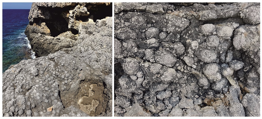
Punta de Ses Taronges (point D). Panoramic view of the outcrop (left). Detail of the rhodoliths (right).
On the surface of the platform, above the Miocene, Pliocene and Pleistocene materials, there appear isolated conglomerates formed by small clasts of the local Miocene. Among these, we can observe some fossils of marine shells. In spite of their very hardened appearance, these materials are relatively modern in geological terms. They correspond to Upper Pleistocene deposits caused by storms and are dated at approximately 125 thousand years ago. One of the best places for observing them is precisely in the vicinity of the Punta de Ses Taronjes.
In addition, dispersed throughout the zone, there are abundant present-day marine shells mixed with small pebbles originating from the seabed. This indicates that the same processes which gave rise to the Pleistocene deposits described above continue to occur today.