| UTM-X | UTM-Y | ||
|---|---|---|---|
| STOP 1: CALA PI | |||
| STOP 2: FACING THE TOWER OF CALA PI | |||
| STOP 3: CALA BELTRAN | |||
| STOP 4: ES BANCALS, SOUTH-EAST SECTOR | |||
| STOP 5: ES BANCALS, NORTH-WEST SECTOR |
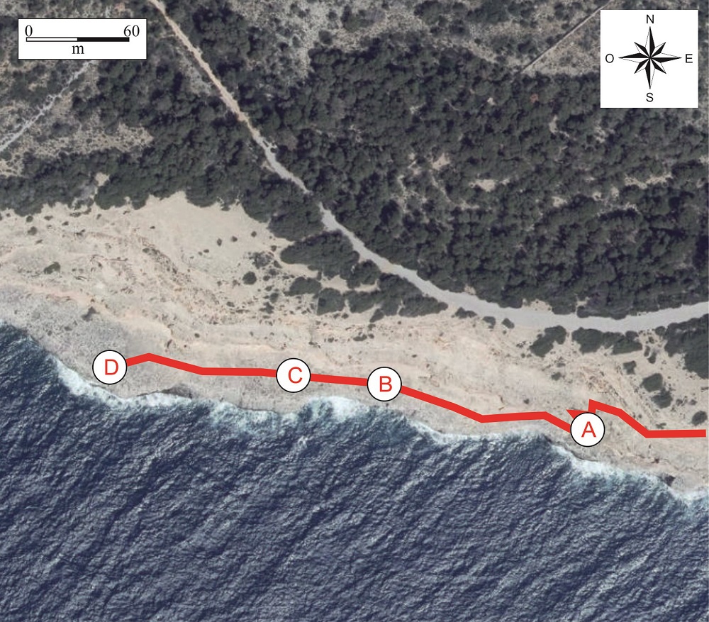
Recommended access.
Ascending the slope and once past an area where the cliff has vertical walls, we see again, in the lower area, the marine abrasion platform formed over the Miocene reef limestones.
Over this platform, once again, there are Pliocene and Pleistocene deposits arranged in steps. In addition, dispersed around the zone there are many rocky blocks that have been detached by the differential erosion between the layers of silts, which are more prone to erosion, and the layers of calcarenites, which develop rock ledges.
In some places, as at the base of the slope (point A), there are large rocky blocks which also correspond to tsunamites.
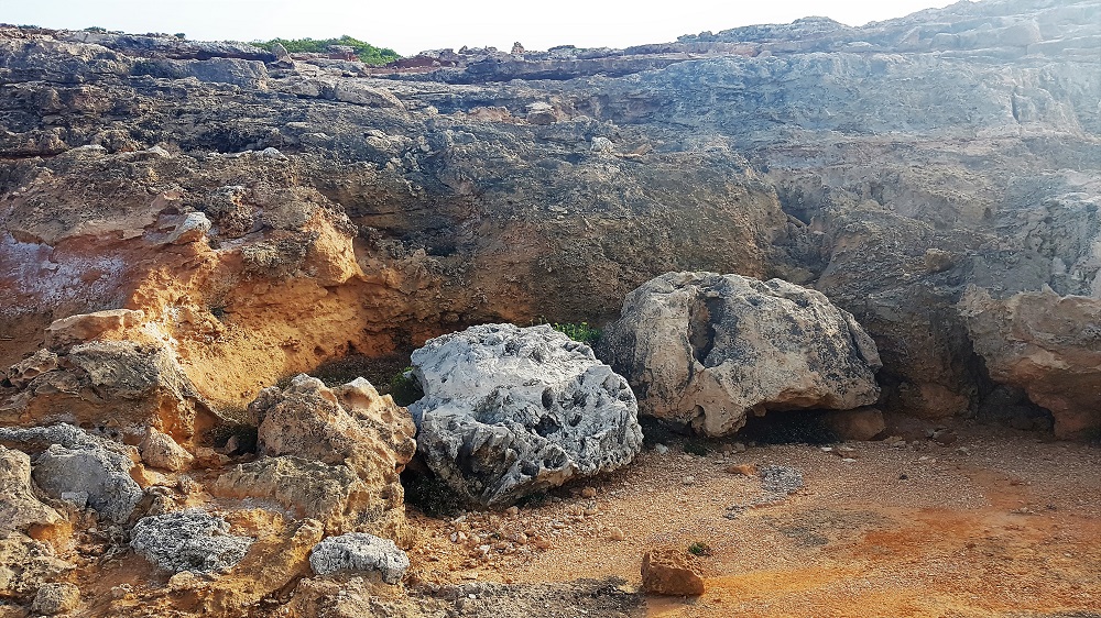
Pliocene and Miocene blocks transported by tsunamis (point A). Note the branching morphologies of the coral in the left-hand block.
A little farther along, point B is the best site for observing the fossils of the Pliocene beaches. There are frequent accumulations of small gastropods (of the genus Cerithium), limpet shells (of the genus Patella) and occasionally ormers or ‘sea-ears’ (of the genus Haliotis).
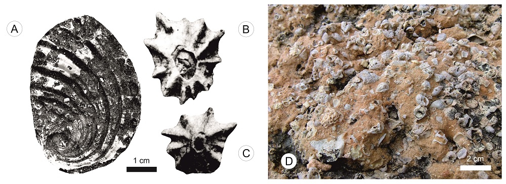
Pliocene mollusc fossils at Es Bancals. A) Haliotis. B and C) Patella. D) Accumulation of small Cerithia. Figures B and C are taken from Cuerda and Sacarés (1970).
Although at previous stops we have already been able to observe the different levels of dunes and paleosols which form the upper part of the cliffs, it is at this last stop where they are most fully developed.
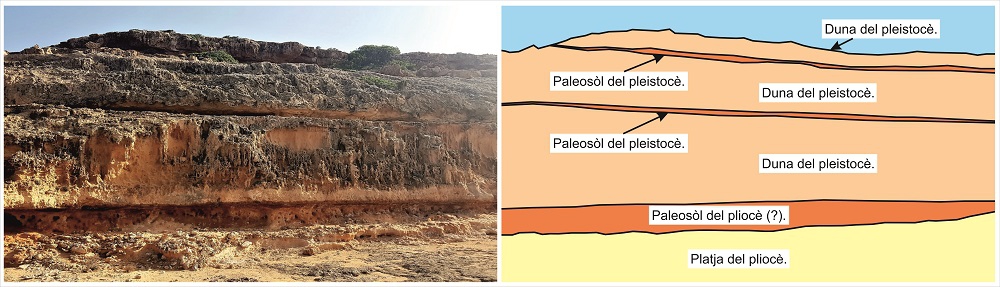
Succession of paleosols and dunes and paleosols of the Pliocene (?) and Pleistocene arranged above the Pliocene beach.
In some of the dune levels we can observe accumulations of rhizocretions, the moulds of roots of plants that inhabited the dunes (point C).
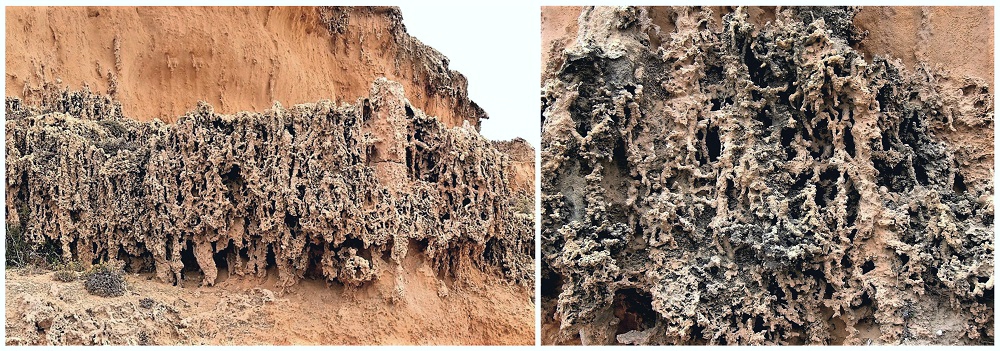
Level of rhizocretions in a Middle Pleistocene dune of point C.
To finish the route, we can approach the clifftop (point D). From here there is a good view of Cap Blanc, an SGI constituted by one of the best Upper Miocene outcrops in the Balearic Islands.
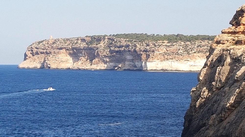
Cliffs of Cap Blanc seen from Es Bancals (point D).
At Cap Blanc, where the cliffs reach their greatest height (90 m), it is possible to observe a section of the enormous coral structures formed by the superimposition of several reef bodies. In contrast with Cala Pi, where the cliffs corresponded mainly to lagoon stratigraphic unit and reflect the specific environmental conditions in which they were formed.</p><p><br></p></div>">facies, here we can see all the stratigraphic unit and reflect the specific environmental conditions in which they were formed.</p><p><br></p></div>">facies of the reef (slope, core and lagoon).
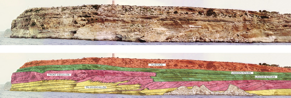
Interpretation of the cliffs of Cap Blanc (courtesy of Pomar).