| UTM-X | UTM-Y | ||
|---|---|---|---|
| STOP 1: THE PERMIAN OF CALA GATA | |||
| STOP 2: THE QUATERNARY OF SON BUNYOLA | |||
| STOP 3: THE MIOCENE OF BEC DE S’ÀGUILA | |||
| STOP 4: THE THRUST FAULT OF ES CAVALL |
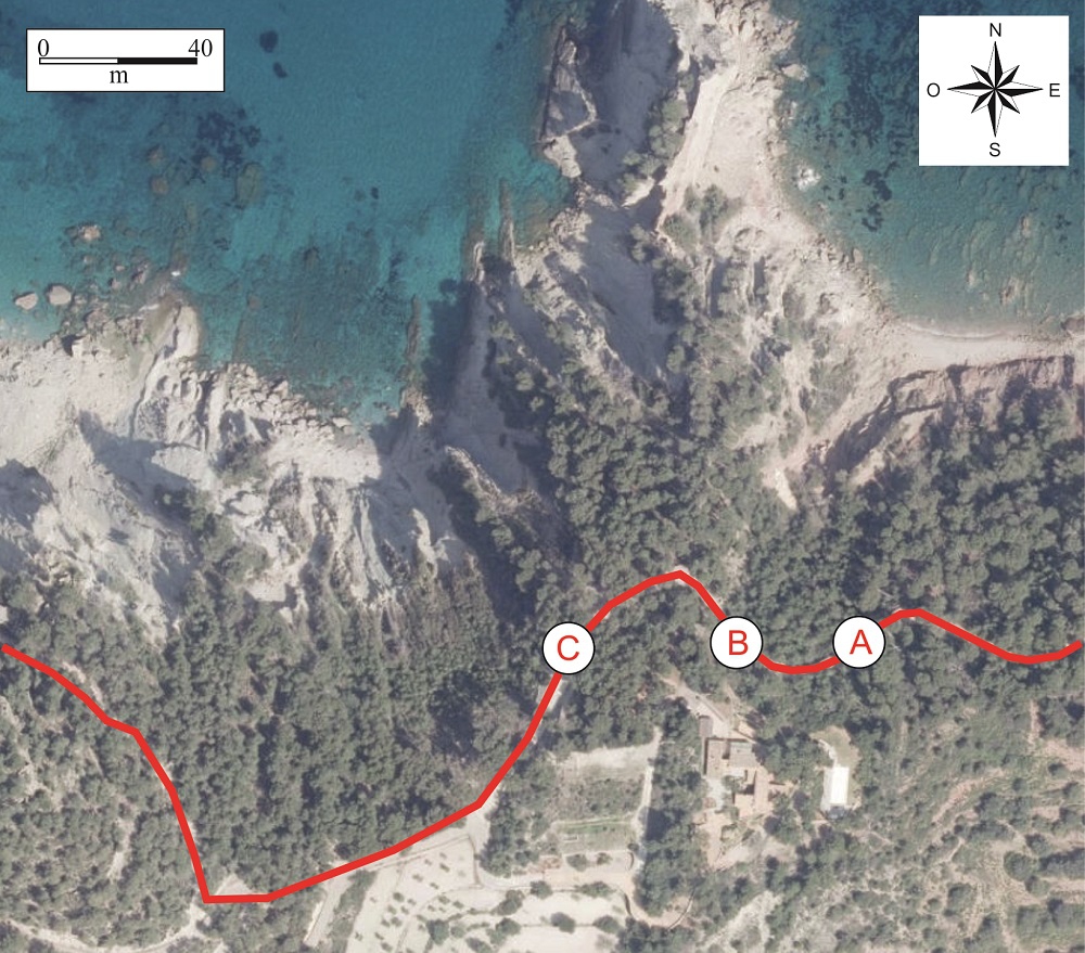
Recommended route.
Continuing along the Volta des General, at point A, we can see that the Permian sandstones begin to display large pebbles (conglomerates), corresponding to the base zone of the Buntsandstein unit and representing an increase in the energy of the aqueous medium in which they were sedimented.
Conglomerates of the base of the Buntsandstein unit (point A)
Farther along (point B) we find Permian sandstones of a whitish colour with marked cross-stratification (similar to those we saw at the start of the route, at Cala Gata).
We can observe that the inclination of the layers varies along the climb. This is because the Permian materials are deformed and affected by folds.
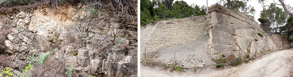
Buntsandstein sandstones with cross-stratification (left) and alternation of sandstones and marls of the Banyalbufar Formation.
Finally, just before the turnoff to the possesió of Son Bunyola (point C), we are surprised by the existence of a vertical alternation of hard and soft layers of yellowish-white and grey colours. These are sandstones and marls of the Lower Miocene.
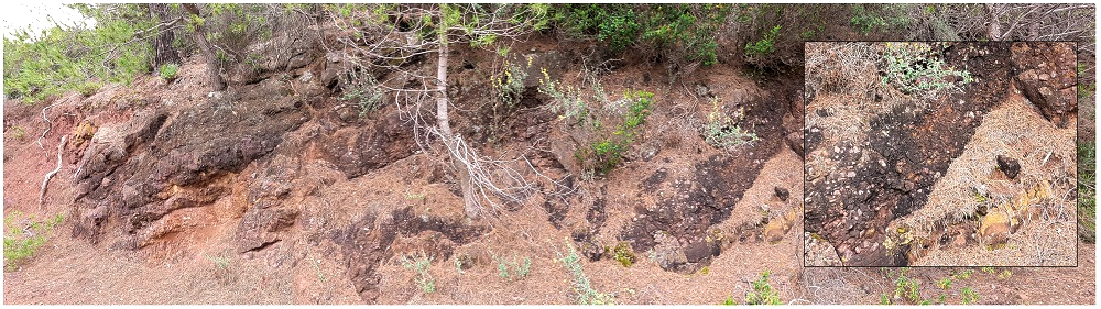
The contact between these Miocene materials and the Permian rocks is mechanical, by means of a fault which is hidden by the vegetation.
From the Lower Miocene (23-16 Ma) we find two geological formations in the area: the Sant Elm Formation and the Banyalbufar Formation.
The former corresponds to marine sediments in shallow waters containing an abundance of oyster fossils. The latter, in contrast, represents much deeper seabeds from the period of the raising of Mallorca during the Alpine Orogeny. The good exposure of the strata of this interval means that it is precisely this zone that contains the tectonic, eustatic or antropical processes</span></p></div>">outcrop of reference of the said formation, technically named stratigraphic succession which can be observed in an outcrop. It is represented graphically by means of a stratigraphic column.</p></div>">stratigraphic section situated in a particular locality (type locality) which serves as a standard model for the rest of the sections of its class. It tends to be the most complete, including the greatest quantity of the geological record, presenting the best-defined geological structures, and so on.<strong> </strong></p><p><br></p></div>">stratotype.
The deposits of the Banyalbufar Formation correspond to a specific type of stratigraphic sequence called turbidite, consisting in sediments deposited after successive submarine avalanches, which in turn are caused by tectonic activity. The avalanches generate a type of flow called turbidity current, which affects large extensions of the seabed, which in turn receive sediment in suspension that finally deposits. The age and origin of the turbidites in Mallorca indicate that they are intimately linked to the birth of Mallorca during the Alpine Orogeny.
At the Bec de S’Àguila, the Miocene displays one more particularity that makes it especially interesting: the lower levels are vertical while the upper levels tend towards the horizontal. This is because the seabed progressively changed its inclination while the strata were successively depositing. This type of sequence is named progressive stratigraphic series or successions.</p><p><br></p></div>">discordance, and to see it in panoramic form we have to view it from the sea. However, as we go along the route at this stop, it is perfectly possible to see how at the beginning we clearly see the vertical strata which decrease their inclination as we move forwards.

Geological profile of the zone of Bec de s’Aguila. Modified from Rodríguez-Perea (1984).
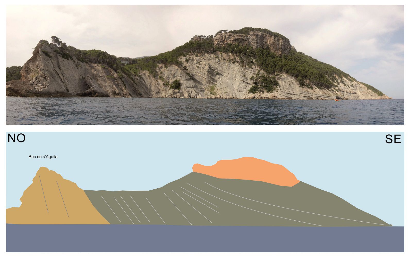
View of the Bec de s’Aguila from the sea.