| UTM-X | UTM-Y | ||
|---|---|---|---|
| STOP 1: PUNTA ROJA HEADLAND | |||
| STOP 2: LA VALL BELVEDERE | |||
| STOP 3: CALA FONTANELLES | |||
| STOP 4: CODOLAR DE BINIATRAM |
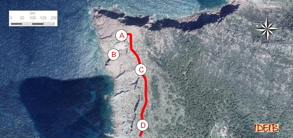
Access to the stopping point.
Access to Punta Roja is from the Es Bot beach, skirting the coastline. Access to the stopping point is not especially difficult, although if you want to see the site in greater detail, you will have to go down the cliffs, which does entail some danger.
If you stand at the end of the Punta Roja headland, you will see some red rocks that sedimented during the lower Triassic, some 250 million years ago. These are red sandstones, rocks made up primarily of grains of sand that were transported by very powerful rivers that eroded large mountains. The deposition of the grains of sand on the river bed and their subsequent consolidation would end up creating these rocks. In Menorca they are popularly known as ‘pedra de cot’ and were used for sharpening and grinding, due to their abrasive properties. So, if you touch the rock, you will see it feels rugged.
We often find them peppered with holes, which give this site a unique beauty. This alteration to the rock is called ‘alveolar or honeycomb erosion’ as it looks like a hive where bees live. The curious erosive forms were created by the wind and abrasion by sea salt and due to the variations in the composition of the rock itself. Erosion “drills away” at the softest points, the ones with less cement, or softer grains, which it makes jump and create cavities. On the harder parts, it sometimes leaves small rock steps, points with higher levels of cement that binds the grains of sand together.
These rocks often adopt whitish colourations. In fact, this should be their usual colour, as the main mineral in these rocks, quartz, is frequently white. The fact that they often adopt red colours is due to the concentrations of iron oxides in the rivers. Very small quantities of oxides can be enough to stain the rock this colour. The presence of iron oxides dissolved in river waters is quite common, and the fact some rocks have not been stained could be because their sedimentation occurred in small and shallow wetlands with practically no oxygen (reducing atmosphere).
Red and white sandstones at Punta Roja and close-up of the honeycomb erosions (point A).
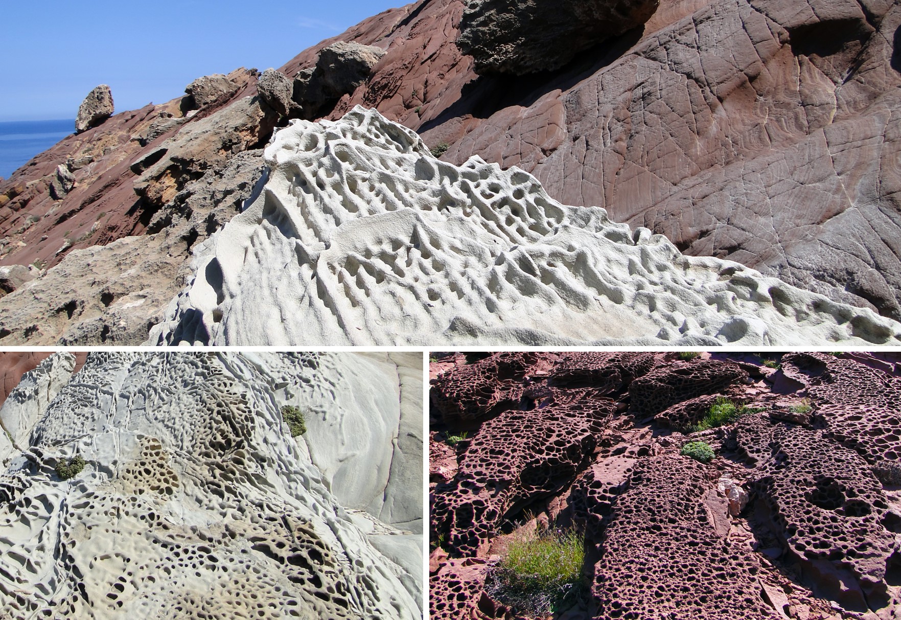
If you approach the cliff along the side demarcating Cala d’Algaiarens, or if you really put your heart into it and climb down, you will be bowled over by a stunning dike of volcanic rock that cuts through the red rocks. This grey structure, which, although it contains greenish tones, is magma that did not break through the ground and as a result cooled and solidified, forming a rock inside the Earth’s crust. Tectonic movements and erosion subsequently placed it on the surface. Although this magma did not reach the exterior, it did open up a path to the surface through pre-existing cracks, giving it its tabular layout. It has a igneous rock of maphic composition (rich in silicates of magnesium and iron and in silica) composed mainly of plagioclase and pyroxene.</p></div>">basalt composition, in other words, rich in magnesium silicates and iron.
Dike of volcanic rock at Punta Roja and interpretation of how this type of structure was formed. The dike is some three metres thick (point B).
If you look closely, you will see that although they criss-crosses the red rocks, the grains comprising it are smaller than the sand-sized clasts.</p><p><br></p></div>">sandstone grains we identified at the start of the stopping point. These rocks can be associated with the clays that were also transported by the large rivers, but which only sedimented when they flooded. At the time, they accumulated extensively along the banks of the river channels, in other words, on the flood plains.
Numerous palaesols can be identified in the clay strata surrounding the volcanic dyke, in other words, “fossil” soils that were also formed during the Triassic and preserved by the subsequent accumulation of sediments. Their presence enables us to deduce that, in the flood area where these clay sediments accumulated, up to thousands of years could pass between periods of the rivers rising and falling as soils can only be formed during prolonged periods of no sedimentation since they need a great many years to form.

Palaeosols interleaved between the clays of the lower Triassic with whitish colourations and close-up of them. Note that as they are more resistant to erosion they stand proud between the clays (point B).
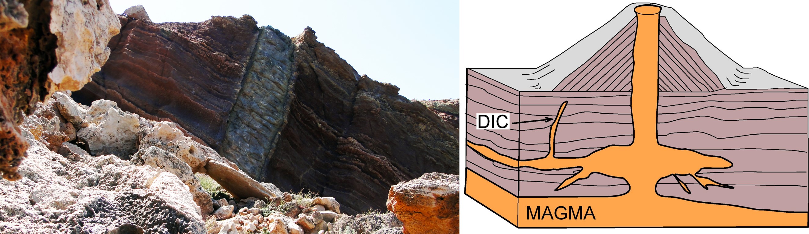
As you head for the next stopping point, you will notice that towards the Algaiarens beaches, there are grey rocks lying on top of the predominantly red ones, which is the reason for stopping place 3. Like the sandstones and red clays, these rocks are inclined due to the effect of tectonic movements that affected them. They have also been sliced through by a whitish or ochreish rock arranged horizontally that gains in top of a stratigraphical unit or stratigraphical sequence. </p></div>">thickness towards the Es Bot beach. This is a dune from the Quaternary, an accumulation of sand, dragged from the beach and deposited inland by the action of the wind and which, over time, has consolidated, giving rise to a rock that we know by the name of marès. These much more recent and consequently not highly consolidated materials are considerably broken, which means the habitual shearing of blocks of this rock from the cliff. The presence of old soil, predominantly clayey, among the materials of the Triassic and those of the Quaternary favour these rockfalls as their easy erosion has opened up a cave, leaving the marès without any support
Fossil dunes from the Quaternary with a horizontal layout that cut through the inclined red and grey rocks of the Triassic. A clayey soil has developed between the two materials, albeit with the presence of cobbles that give it the nature of a sedimentary rock of detritic origin (clasts larger than 2 mm).</p></div>">conglomerate. These materials erode easily, which has enabled the opening of caves, favouring the fall of the overlying materials and the tilting of the whole level towards the sea with the appearance of major cracks (point C).
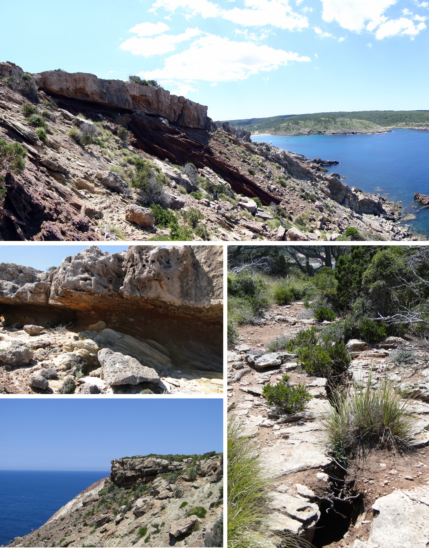
Instabilities in the rocks from the Quaternary can also be seen in the cliff that runs along the western edge of Platja des Tancats; you get some stunning panoramic views of them from this stopping point. In this case, materials that have slipped and come to a stop in the sea have left a half-moon surface on the cliff. This type of movement is reminiscent of the effect that would be left by a giant spoon scooping out the materials that broke off.
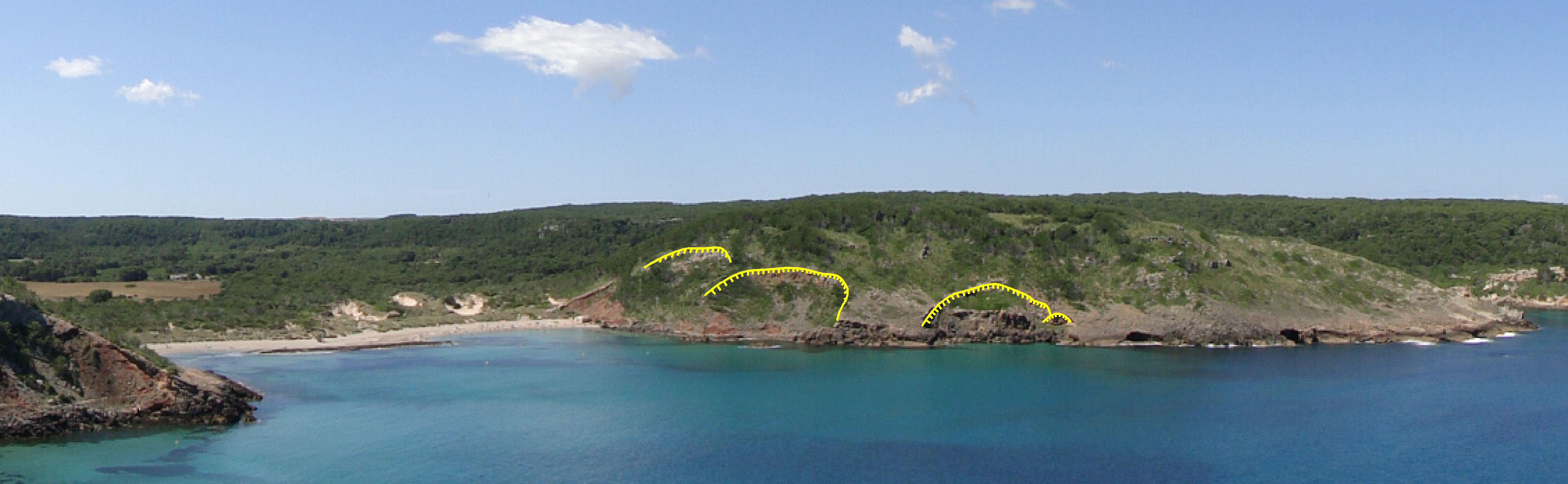
Platja des Tancats and the cliff on its western edge. The scars created by half-moon shaped slippages of materials from the Quaternary have been marked in yellow (point D).