S’Albufera des Grau is Menorca’s main wetlands reserve; it is the centre of the natural park of the same name and the very heart of the Biosphere Reserve. With an irregular perimeter, it is elongated and narrow measuring 1.7 km in length with a maximum width of 900 m. It covers 72 hectares with a maximum depth of around 3 metres, but an average of 1.4 metres. There are four islets on its western edge: En Mel, the largest of them and home to the only Balearic gecko population, Es Pardal, En Petit and Es Soldat. It has shrunk from its original size over the years, due to the arrival of sediment that has refilled it and it has lost part of its surface area and storage capacity. The areas around S’Albufera that have slowly silted up with sediment have sometimes been drained, using small channels so that the land can be used for crop growing.
This salty lagoon is connected to the sea by a narrow channel called Sa Gola, which is about 500 metres long and 10 metres wide. S’Albufera lies at sea level and is partially separated from the sea by a system of dunes. Its isolation is not entirely down to the Sa Gola channel, but sometimes during the summer months, together with the drier months of the year, the sand also closes the mouth of the lagoon at this point, completely blocking off access to the sea via Sa Gola. In any event, the arrival of freshwater and salt water creates conditions that contribute significantly to its high ecological value.
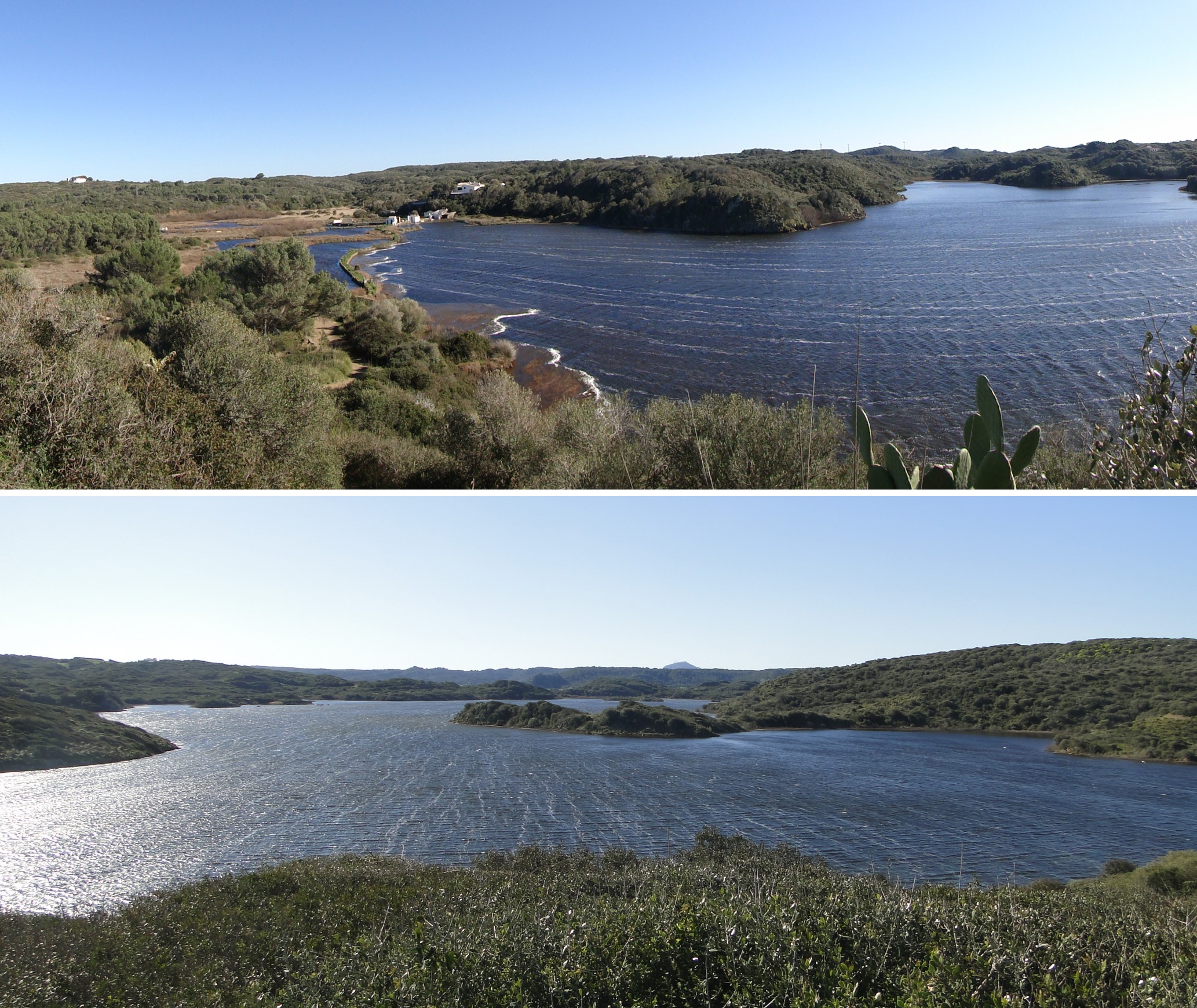
Views from the southeast to the northwest of S’Albufera des Grau.
The wetlands cover a depressed area on Palaeozoic rocks. The depression where it is situated was probably formed by the erosive action of different streams at a time when the sea level was lower than today, which favoured the layout of the flood system. However, the course that the streams followed should not be seen as happening by chance, as they used a series of east-to-west-facing fractures here to help with their development. S’Albufera probably formed a gulf or bay with the space occupied by today’s Es Grau beach, making it open to the sea. The accumulation of sand creating a line of dunes would lead to it being practically cut off from the sea and its consequent development as wetlands.
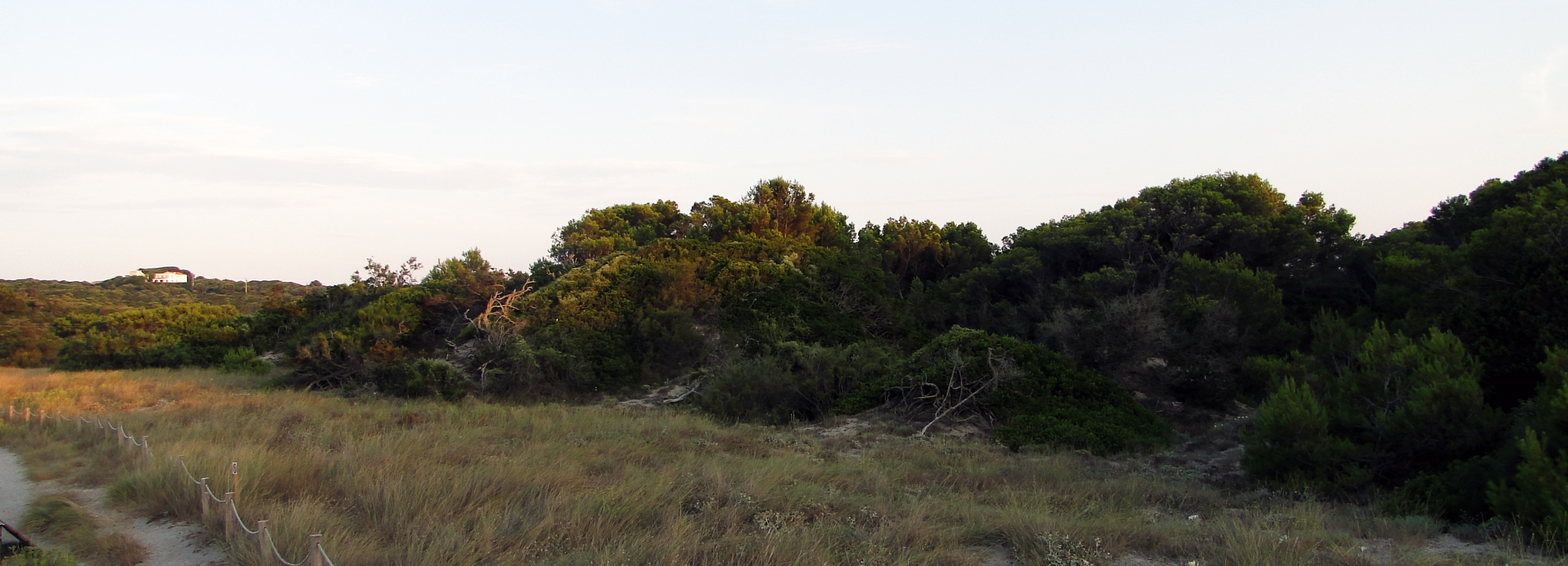
Line of dunes demarcating the lagoon and the sea. In the foreground are small mobile or embryo dunes with marram grass (Ammophila arenaria), and behind these covered dunes that have been stabilised by pine trees and tamarind trees.
One of the main characteristics of S’Albufera is that it is surrounded by small hills, high enough that they appear sunken and huddled together, creating shores cut out into coves and headlands. In fact, this landscape could be compared to how it looked when the space occupied by the lagoon was open to the sea. Alternations of sand-sized clasts.</p><p><br></p></div>">sandstone and lloselles, the predominant Paleozoic rocks in Menorca, form a coastline of small, gently undulating hills and a highly uneven and rugged rocky shore, with lots of inlets (coves) and promontories (headlands and points).
Its basin is quite extensive, covering an area of 30.25 km2 and drained by three streams. The most important is the Es Puntarró stream in the west, which merges very near S’Albufera with the Sa Boval stream that flows from the north, and together they then flow out into the western edge of the wetlands. Unlike the others, the Na Bona stream in the south flows exclusively through Paleozoic materials.
As a result, S’Albufera’s sphere of influence is not limited to the lagoon situated on the impermeable Paleozoic rocks, but its basin includes the permeable Sedimentary rock whose main component is calcium carbonate (CaCO3). Its origin can be chemical, organic or detritic.</p><p><br></p></div>">limestone Mesozoic rocks that form the aquifers that influence the lagoon. The water in the Es Puntarró stream replenishes the aquifers and the water in this stream may also emerge as springs and reach S’Albufera. Unfortunately, the high pressure to which the aquifers are subjected has caused their levels to drop and many springs to disappear and the water that now reaches S’Albufera is only rainwater, as there is almost nothing from the aquifers, which has led to excess salinization and desiccation or mud cracks that have traumatic consequences for flora and fauna.
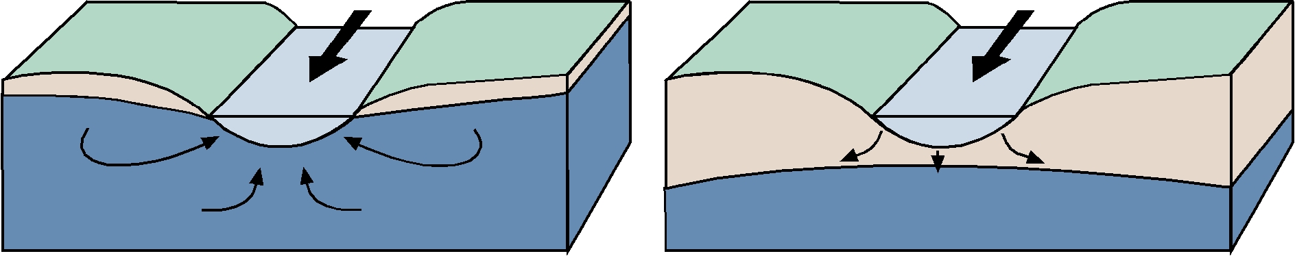
Relationship between streams and aquifers. Rivers can obtain water from underground water sources, which in turn may occur as springs along their banks or close by. So, if the level in the aquifer is lower, the river can lose water by transferring it to the aquifer. In this case, as it is far from the topographical elevation, underground water does not appear as springs. The Es Puntarró stream is a good example of this change in the relationship between streams and aquifers caused by an anthropic drop in aquifer levels, which has resulted in less freshwater reaching S’Albufera.
This means that the point where freshwater and salt water meet must be managed using floodgates that shut off S’Albufera’s communication with the sea and allow salt and water levels to be controlled within certain limits.
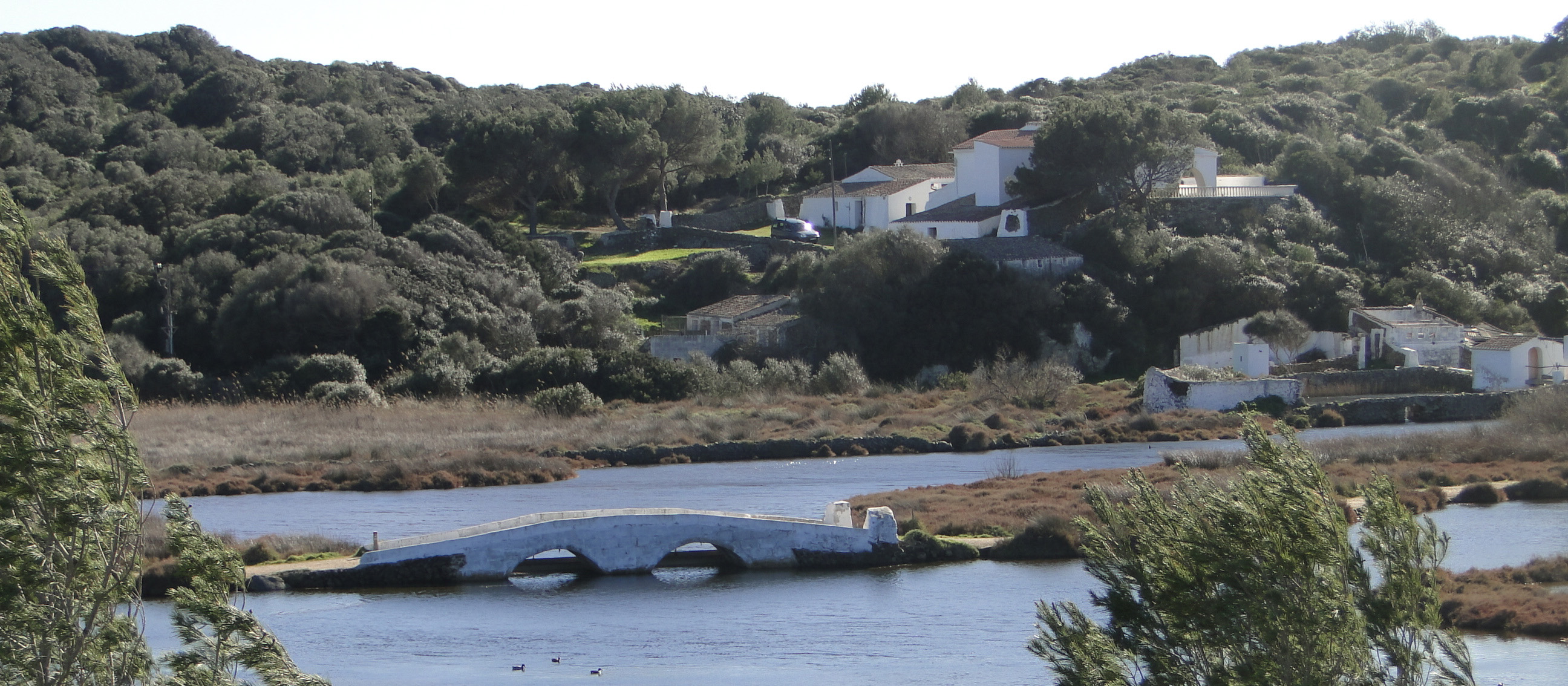
Bridge with the floodgates used to control the flow of water between S’Albufera and the sea. This form of control was traditionally used for fishing purposes, but today it is geared towards conservation of the lagoon.