We suggest a geological trail along one of the deep ravines of the central part of Menorca’s Migjorn region from the point of view of a multidisciplinary aspect of geology. Consequently, you will see not only aspects relating to the characteristics of the rocks that make up the walls of the ravines, but also the geological risks that arise from the vertical nature of the cliff faces, the hydrogeological features that determine the appearance of springs and the geomorphological and tectonic factors that led to their creation.
The Barranc d’Algendar ravine is an exceptional place for getting to know the geomorphological dynamics of the south of the island, besides the existence of imposing walls that enable us to understand the principal lithological features of the marès. In this way, the Place of Geological Interest is the ideal place to reveal not only the hydrodynamics of Menorca’s Migjorn region, but also its problems, related especially to the fresh water springs and to the geological risks of falling blocks on the sides of the ravine.
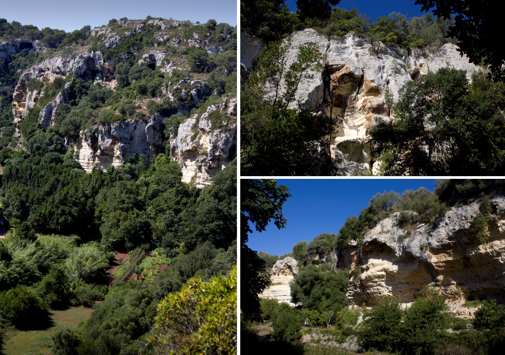
The Algendar ravine is a natural site of great beauty and one of Menorca’s most characteristic and unique settings.
Its natural values mean that many of its sites convey a very different atmosphere from the usual landscapes of Menorca to the visitor. It begins in the Tramuntana region, is 8.5 kilometres long from the Puig de Santa Magdalena down to Cala Galdana with an almost rectilinear path and comprises deep fluvial canyons in walls cut into the Miocene marès and inclines of around one hundred metres. Although it has an overall direction, the ravine describes numerous twists and turns, displaying a very long fluvial section of between 50 and 100 metres wide, with vertical walls in several sections of an average height of 50 metres and a maximum of nearly 80 metres.
The Barranc d'Algendar ravine is the most easily-accessible ravine in the central area of Menorca, as others such as Trebalúger and Cala en Porter have greater limitations on access due to the presence of private properties. Even so, you shouldn’t forget that there are numerous properties whose access from Cala Galdana is private. Because of this, the trail follows Camí Reial and especially makes use of the Pas d’en Revull and Es Torretó created by the Island Council of Menorca, with the option therefore of complementing the geological information of this route with the information available in these trails.
02:00
We suggest starting the visit at Pas d’en Revull and continuing along the Barranc des Canaló ravine. From Ferreries, you will need to take the detour to the Barranc d’Algendar ravine (at the roundabout where the main road meets the road from Cala Galdana and the entrance to Ferreries) until you reach Es Canaló which has a car park very close to the summer camp. You can also access it on foot along a 3.5 km section of Camí Reial old road from the village of Ferreries. Another option is to make a stop (number 4) as far as the Es Torretó farmhouse, where you will need to add a distance of 2.3 km and approximately 45 minutes to your visit. You should remember that, in this case, the trail can be completed in the opposite direction, starting from Es Torretó. If you choose this option, at the main road between Ferreries and Ciutadella you should take the Camí de Binigarba road until you reach the Camí Vell de Ciutadella road and follow the signs to the Es Torretó summer camp farmhouse. Also, both ends of the trail offer direct access by vehicle, so you can consider dividing the route into two different visits.