| UTM-X | UTM-Y | ||
|---|---|---|---|
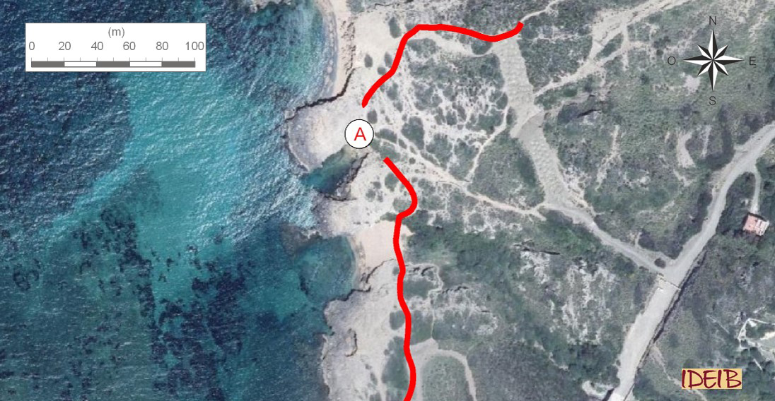
| STOP 1: THE FOSSIL DUNES | |||
| STOP 2: LIMESTONES WITH CRINOIDS | |||
| STOP 3: PHOSPHATE NODULES | |||
| STOP 4: ESCULL DES FRANCÈS | |||
| STOP 5: RED LLOSELLA | |||
| STOP 6: RADIOLARITES | |||
| STOP 7: THE CALESMORTS THRUST |
Access route to the stopping point and continuation towards the next one.
In the main, the rocks at Binimel·là are rocks sedimented during the Palaeozoic, specifically in the Devonian and Carboniferous, between around 410 and 324 million years ago. However, the area displays other elements of geological interest, such as the fossil dunes, the reason for this stop on the trail, which are the result of accumulations of sand dragged from the beach, transported and sedimented by the action of the wind, which have, over time, undergone a process of consolidation, giving rise to a rock, calcarenite, known in Menorca as marès.
These rocks were formed during the Quaternary, the latest of the geological periods, developed between 2.5 million years ago and the present day. During this period, Homo sapiens appeared on the Earth and numerous animal and vegetable species became extinct. In addition, the Earth was affected by climatic alternations between cold periods (glacial) and warm periods (interglacial), which gave rise to significant variations in the sea level. The glacial periods were times of global drops in temperatures, which caused the accumulation of large masses of ice on the continents. The warm interglacial periods caused a global rise in temperature and the ice in the ice caps to melt, which led to a rise in sea level.
Consequently, during the cold periods, the water on the Earth accumulated at the geographical poles and on the mountains in the form of large glaciers, and consequently, the sea level fell. During the last glaciation, the sea level in the Mediterranean was some 120 metres below the present level, which led to Mallorca and Menorca forming a single island. These drops meant that huge extents of sand that were originally under the sea were left uncovered and could be dragged by strong winds that, if they were blowing from the sea inland, drove them to the coast and left them piled up, resulting in large dunes that would, over time, constitute the rock we know by the name of marès. This pronounced fall in the sea level would explain why many marès deposits caused by wind action are now under the present sea level.
The dunes cover the whole of the eastern side of Cala Binimel·là. As they are "recent” rocks, they are not highly consolidated and are porous, so that erosion has been able to act on them more easily, giving rise, for example, to a series of small beaches situated on this side of the cove. Its low hardness means that this rock is known on the island as ‘poor marès’ due to the comparison with the marès on the south of the island, sedimented during the Miocene, which is older and more consistent.
In these small eastern inlets of Binimel·là, we can see superb examples of large-scale cross stratifications. This is a type of sedimentary structure resulting from the layout of the grains of sand, which arrange themselves in laminae that form angles between them. The arrangement is a reflection of the advance of the grains of sand due to the action of the wind that created these dunes.
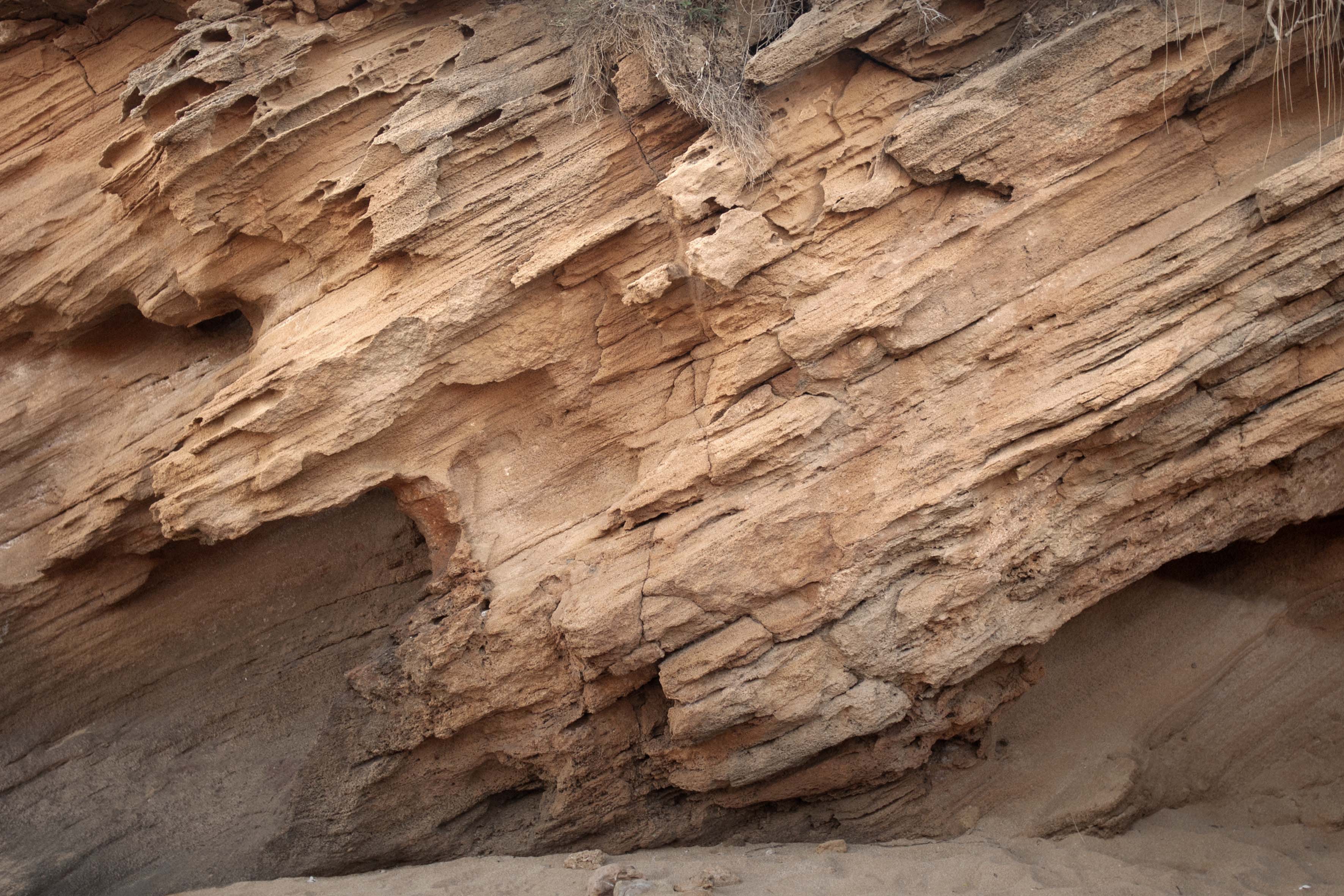
Cross stratifications in the marès caused by the action of the wind, forming dunes, in the small beaches on the eastern side of Cala de Binimel•là (point A).