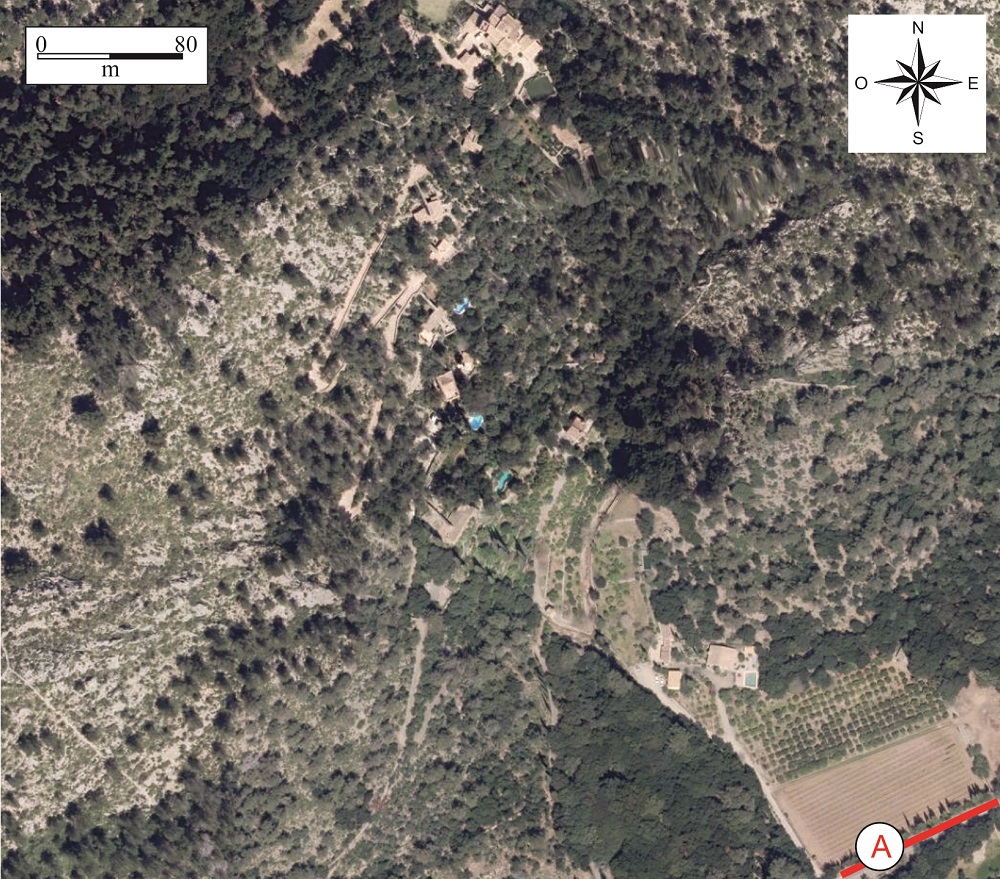
Point where the watermills of Llinars are observed.
At approximately km point 3+500 of the Ma-10 road, to the right (point A), we can view the Watermills of Llinars.
They constitute a hydraulic engineering work in which the six mills are strategically located in steps to fully exploit the fall of the stream of Sa Font de Llinars.
The mills date from the Arabic period, when the water was conducted along a channel and fell through a tronco-pyramidal tower some 8.0 metres in height. The force of the water moved millstones weighing several tons which crushed the grain to make flour.
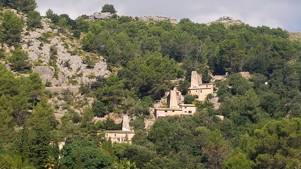
View of the mills from point A of the Ma-10 road.
The Ma-10 road runs through the Vall d’en Marc, surrounded by spectacular mountains. This valley, covered by Quaternary alluvial materials, corresponds to the base of one of the fault
<div class="ql-editor"><p class="ql-align-justify">Inverse fault in which the stratification plane.</p><p><br></p></div>">dip of the fault plane is at a low angle (generally less than 45<sup> o</sup>). It tends to refer to large-scale (regional) structures.</p><p><br></p></div>">thrust fault fronts which form the Serra de Tramuntana.The Serra de Tramuntana originated during the Alpine Orogeny, a stage of intense geological activity which commenced some 25 Ma ago. In this period, the materials of the earth’s crust were fractured and piled up on each other by low-angled inverse faults. This type of phenomena is called thrust faults, and when they are superimposed they are said to be imbricated.
In general, thrust faults are created when a hard material, in this case the Lias (Lower Jurassic, 201-175 Ma), slides over a soft material, in this case the Keuper and the Rhaetian (Upper Triassic, 237-201 Ma), which is named the décollement or gliding plane.
As a result of this structure, the Tramuntana range presents abrupt escarpments and cliffs on its NW slopes, as in the zone of Sa Calobra, while to the SE the slopes descend smoothly towards Es Raiguer, in the Inca area. The orientation of these asymmetric reliefs indicates the direction in which the tectonic forces acted, in this case SE-NW.
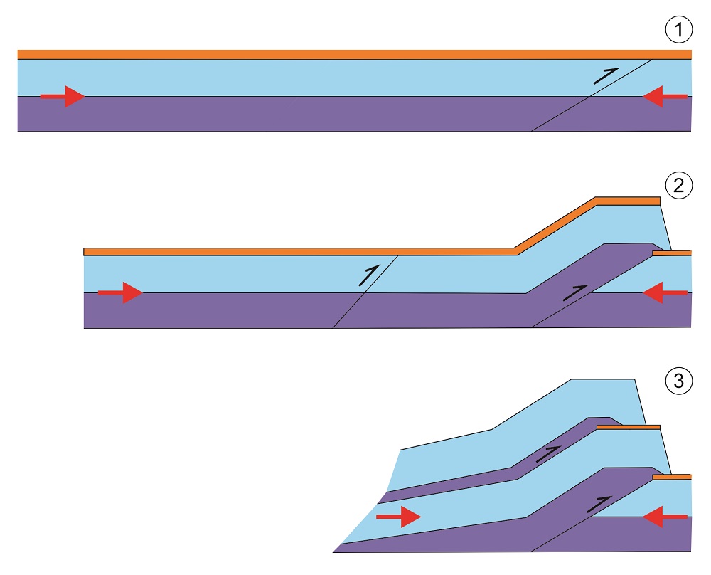
Formation of imbricated thrust faults.
Looking to the left we see the enormous rocky masses formed by the materials of the Lower Miocene and the Lias which have slid over the softer materials of the Rhaetian and the Keuper (Upper Triassic) which form the floor of the valley.
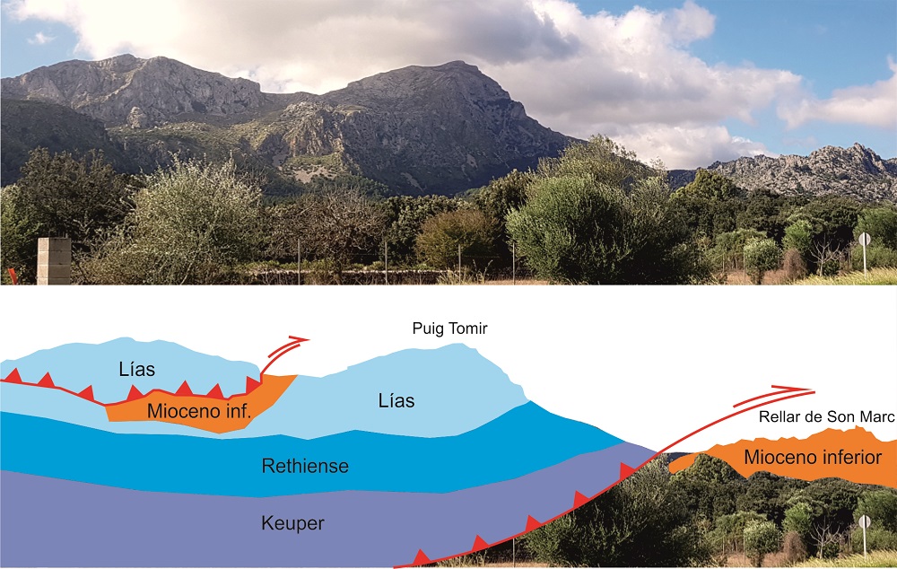
Simplified diagram of the geology observable from the road.