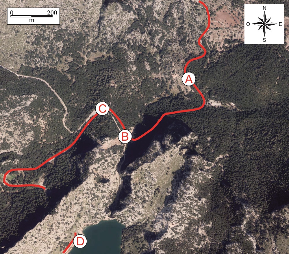
Recommended route. Viewpoint of the rockfall (A), rockfall (B), aqueduct (C) and Gorg Blau reservoir (D).
A little farther along, at km point 28+300, looking south-west we can see the scar left by a large rockfall that took place on 31 December 2008 and blocked the Ma-10 road.
This was the Gorg Blau rockfall, which affected an area of 12,000 m2 and displaced 30,000 m3 of material, mainly rocks.
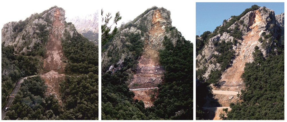
Appearance of the rockfall shortly after it occurred (left), with the first protective measures (centre) and the definitive
The rockfall was caused by the breakage of a rocky wedge after a period of heavy rain and low temperatures, which undoubtedly favoured the processes of gelifraction (opening of the cracks in the rock due to the freezing and expansion of the water inside it).
Once the road surface had been cleared and repaired, a series of protective measures were installed.
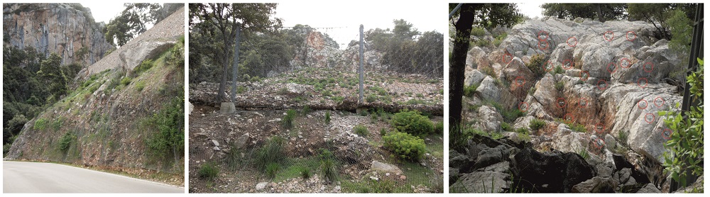
Protective measures: triple-torsion mesh (left and centre), dynamic barrier (centre), steel bars and membrane (right).
Just before reaching the turnoff to Sa Calobra, the road passes under the Turixant aqueduct (point C). This was used in the past to transport water from the Gorg Blau stream in the area of S’Estret, where the dam stands today, to a small hydro-electric power station located downstream very close to the aqueduct. This power station, built in the 1920s, took advantage of the height difference to generate electricity.
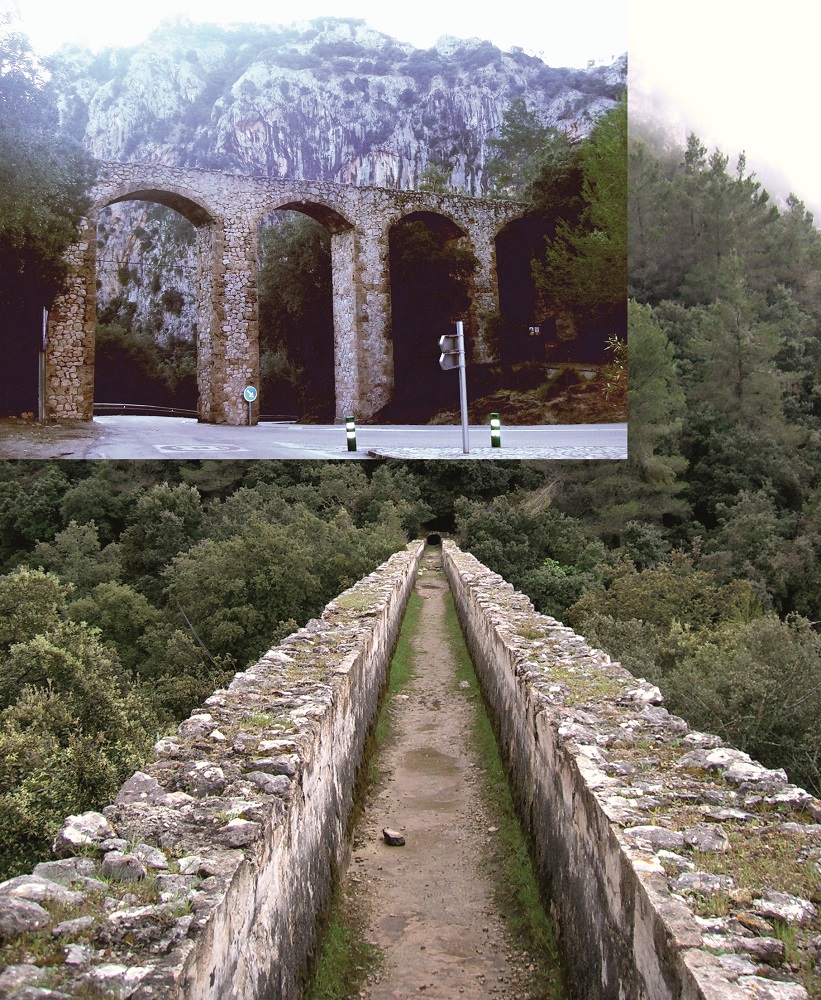
Turixant aqueduct (point C)
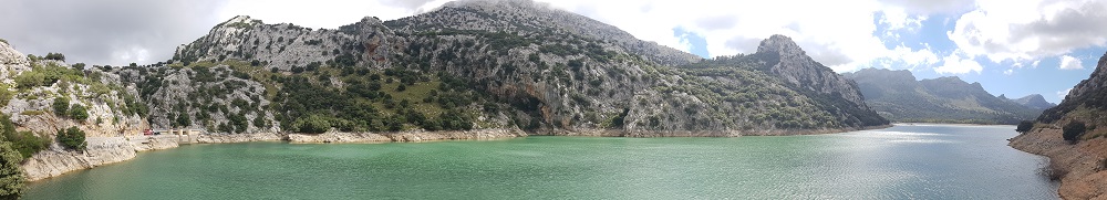
Finally, it is worth stopping at the Gorg Blau dam (point D). This dam, together with the Cúber’s, is the only reservoir existing in the island of Mallorca.
It was constructed in 1971 in the Almallutx valley and has a capacity of 7.34 hm3. The dam, that closes it, is a vaulted arch dam. At the base of the dam there is a pumping station which, by way of pipelines which climb up the slope of the mountain, sends water to the Cúber reservoir, our next stop.
Gorg Blau reservoir (point D)