The shore of the Puig of Bàlitx (580 m above sea level) corresponds to a depressed zone of triangular morphology surrounded by sheer cliffs almost 100 m in height. It displays numerous signs of instability, constituting the largest active landslide of the Balearic Islands.
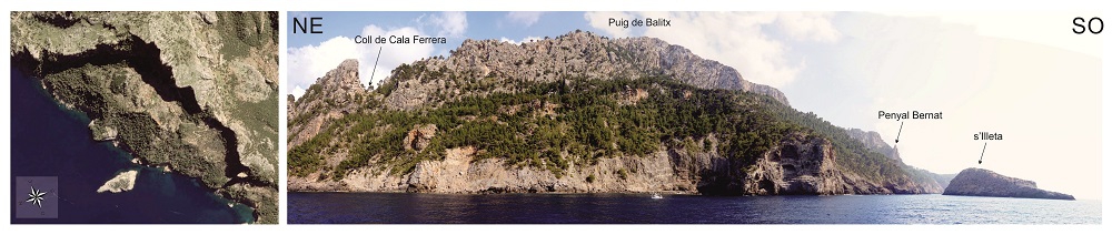
General view of the Bàlitx zone from satellite (Google Earth) and from the sea.
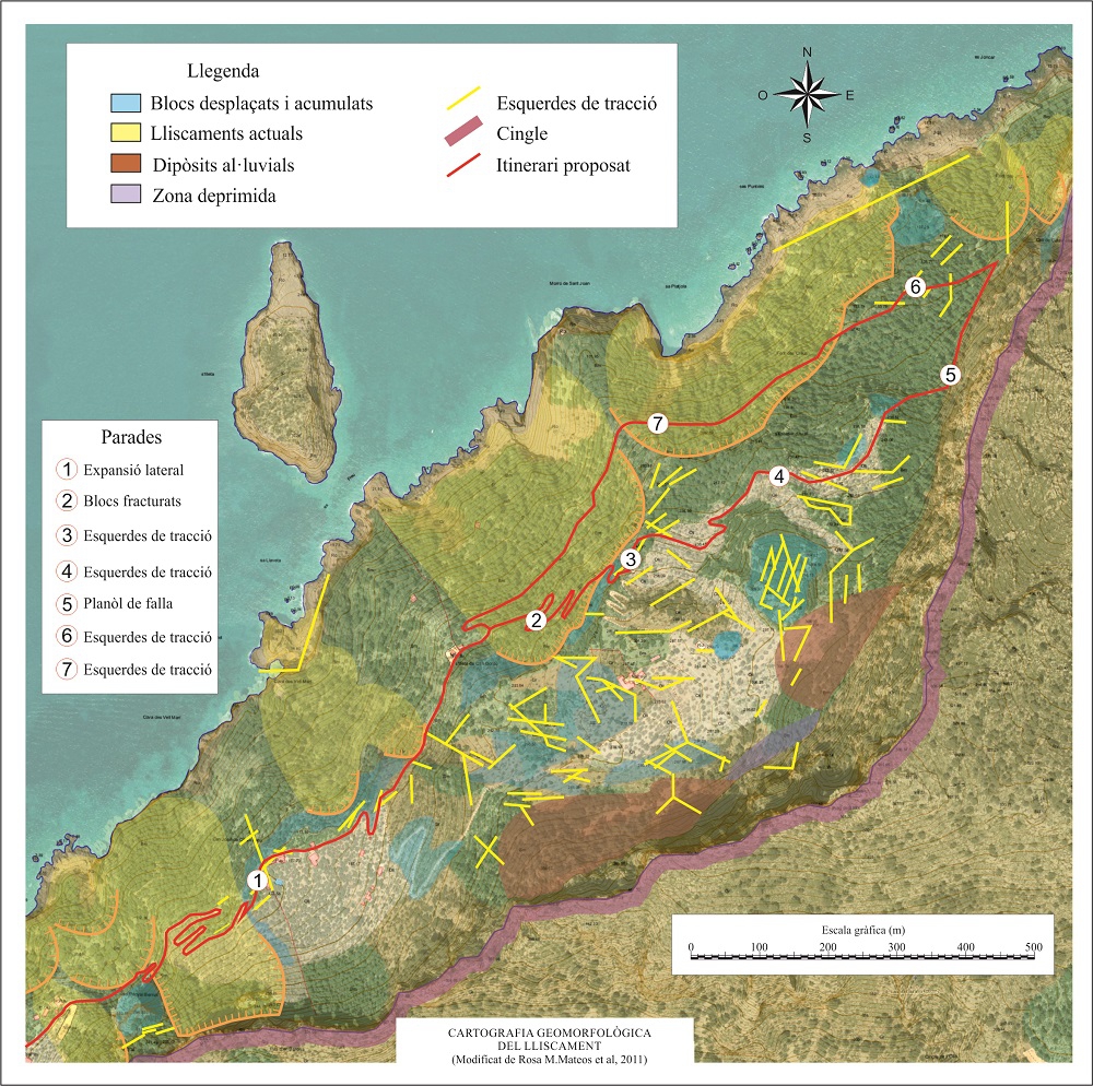
Cartography and proposed itinerary of the Bàlitx landslide.
The coastline of the Serra de Tramontana Central is characterised by outcrops of materials of the Triassic and the Lower Miocene (Tertiary), which, being softer, give rise to very steep hillsides crowned by the much more resistant Sedimentary rock whose main component is calcium carbonate (CaCO3). Its origin can be chemical, organic or detritic.</p><p><br></p></div>">limestone cliffs of the Lower Lias (Jurassic).
The Bàlitx shore corresponds to a fault
<div class="ql-editor"><p class="ql-align-justify">Inverse fault in which the stratification plane.</p><p><br></p></div>">dip of the fault plane is at a low angle (generally less than 45<sup> o</sup>). It tends to refer to large-scale (regional) structures.</p><p><br></p></div>">thrust fault front formed during the uplifting of the Serra within the framework of the Alpine Orogeny, some 20 Ma ago. At the base of the fault<div class="ql-editor"><p class="ql-align-justify">Inverse fault in which the stratification plane.</p><p><br></p></div>">dip of the fault plane is at a low angle (generally less than 45<sup> o</sup>). It tends to refer to large-scale (regional) structures.</p><p><br></p></div>">thrust fault there is an tectonic, eustatic or antropical processes</span></p></div>">outcrop of the Upper Triassic, displaying soft materials that favour instability processes.In the Jurassic reliefs there are frequent rockfalls, the result of fracturing of the rock due to gelifraction processes (breakage of the rock due to frozen water in its cracks acting as a wedge), and probably seismic processes (low-magnitude earthquakes imperceptible for human beings). However, in the hillsides, composed of softer materials, there are rotational landslides (also named ‘circular’ or ‘spoon-shaped’) and lateral expansion phenomena.
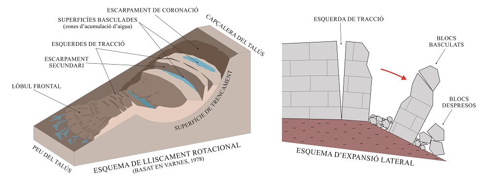
Diagram with the characteristics of a rotational landslide and a lateral expansion phenomenon.
The best example of lateral expansion is seen at the start of the route: the Penyal Bernat, the best spot for observing it being the path going up towards the houses of Can Joan de Ca sa Dida (point 1).
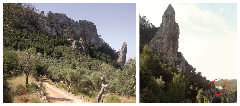
View of the Penyal Bernat from the path and detail of the house located nearby.
With the passing of time, the rockfalls that accumulate at the foot of the cliffs in the form of colluvial deposits can undergo a process of cementation which gives rise to a very characteristic type of rock: breccias (sedimentary rock constituted by blocks and angular gravels). These rock formations are very abundant in the Bàlitx zone, reaching thicknesses of dozens of metres.
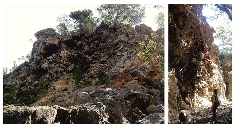
Breccias in the coastal cliffs and in the zone of point 6.
Due to the instability of the hillside, numerous traction cracks have emerged, with great continuity and depth. Their openings range from a few centimetres (like those observed at point 4) to several metres (it is possible to walk into some of them, as at points 3 and 6). These cracks affect fundamentally the breccias (points 3, 4, 6 and 7) and the large fallen Sedimentary rock whose main component is calcium carbonate (CaCO3). Its origin can be chemical, organic or detritic.</p><p><br></p></div>">limestone blocks (point 2).
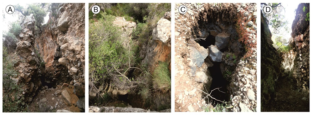
A) and D) Large-opening cracks that can be walked into (points 3 and 6 of the route). B) and C) Cracks of metric dimensions, with great depth and continuity (point 4).
As could be expected in this type of instabilities, in the head zone there is a depressed area where water and moisture accumulate (purple colour in the diagram) due to the swinging of the materials
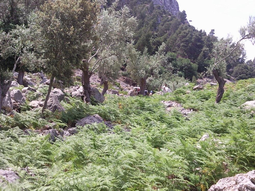
Ferns in the depressed zone of the head of the landslide
Finally, special mention must be made of a magnificent fault mirror in the eastern flank of the fault
<div class="ql-editor"><p class="ql-align-justify">Inverse fault in which the stratification plane.</p><p><br></p></div>">dip of the fault plane is at a low angle (generally less than 45<sup> o</sup>). It tends to refer to large-scale (regional) structures.</p><p><br></p></div>">thrust fault front (point 7). This type of structure is formed by the friction of the movement of the fault, which crushes and polishes the rock. By studying the striations and crystallisations of its surface, it is possible to know the direction of the movement and its approximate age.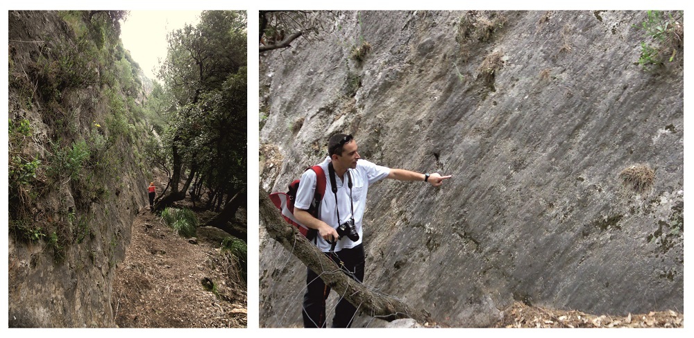
Fault mirror at point 5 of the route