In addition to being one of Mallorca’s most famous beach zones, Es Trenc is one of the best points for studying the dunes, their formation and their relationship with climate changes in recent geological times.
The beach-dune system of Es Trenc constitutes an arc-shaped fringe approximately 5.6 km long and some 600 m wide, stretching from Sa Ràpita in the north-west to the Colònia de Sant Jordi in the south-east. In its central part there is a small rocky coast zone known as Ses Covetes. The north-west sector is known as the Arenal de Sa Ràpita, while the south-east part is what is strictly named Es Trenc.
This is a beach-lagoon system displaying a distinction between a submerged maritime or infralittoral zone, a subaerial beach zone (mesolittoral and supralittoral zone, foreshore and backshore) and a dune zone.
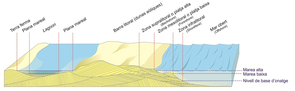
Beach-lagoon system.
In the case of Es Trenc, the dune zone is very well developed and has a lot to do with the presence of meadows of posidonia, the famous endemic subaquatic plant of the Mediterranean. Posidonia is the sustenance of an ecosystem which features an abundance of foraminifera, a single-cell micro-organism that tends to have a calcareous shell, along with a multitude of molluscs, also with shells.
As these die, their remains sediment on the seabed, forming large accumulations of sand over thousands of years. This process is interrupted when a cold period occurs and lowers the sea level due to the expansion of the polar ice. Then these extensions of sand are exposed to the elements and the coastal winds, which transport them and pile them up in the form of dunes.
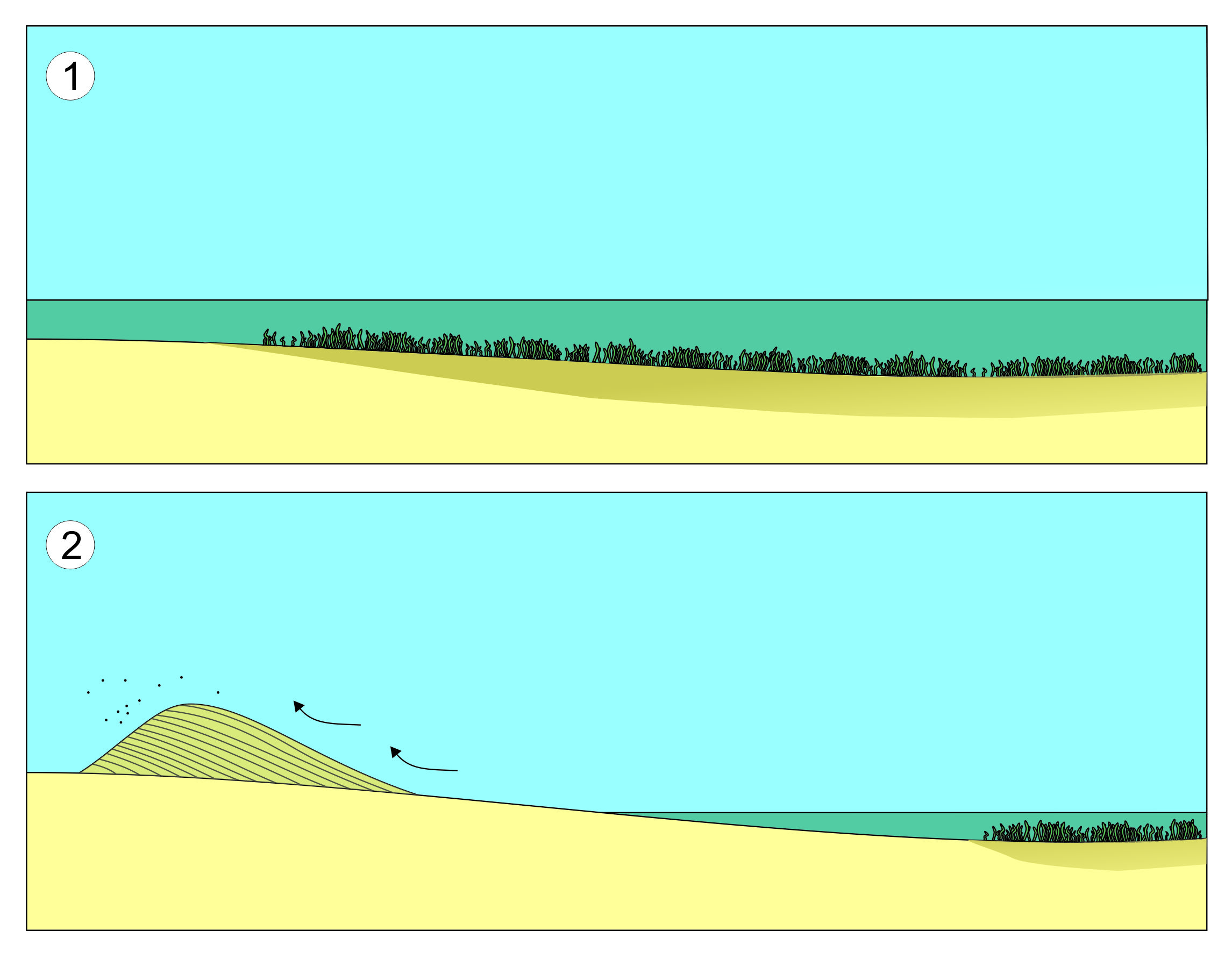
Diagram of the formation of dunes.
As the slope of the coastline of the Es Trenc zone is extremely gentle, the quantity of sediment that was exposed in cold periods is greater than in other zones, a factor that favours the formation of dunes more than in other places. At the same time, the dead posidonia tends to accumulate on the shore, forming a natural barrier that protects the beach and the dunes.
It is precisely the artificial elimination of these barriers that makes it necessary for Mallorca’s beaches to be constantly regenerated. This deterioration is very visible in Es Trenc, where the beach has receded in recent years even to the extent of uncovering the foundations of a series of bunkers which for decades had been half-buried in the sand.
At Es Trenc three periods, with a very substantial formation of dunes, can be recognised. These are occurred during the Holocene, the present geological age, which began some 10,000 years ago.
The oldest dunes stand slightly inland and are fixed, that is to say, they have settled and consolidated in such a way that they are no longer moved by the wind. In contrast, the dunes close to the shore are mobile, changing their position and physiognomy according to the prevailing winds. Between the two zones there is a transition sector with semi-stabilised dunes.
Adjoining the beach there is a final barrier of dunes parallels to the coastline: the foredunes.
Underneath all these dune systems, older sediments from the Pleistocene can occasionally be recognised in some areas. These are mainly fossilised dunes, although there are also remains of ancient beaches with a few fossils of marine molluscs.
The best zone for observing ancient dunes is in the Clot de s’Arena, an old sand quarry now covered by vegetation.
The operations of sand extraction left embankments where we can observe in cross-section various dunes in the process of fossilisation, superimposed one on another with some interspersed clayey levels which were deposited in warm, humid periods, which illustrates the evolution of the island’s climate in the last six millennia.