You will get superb views of the geological landscape of Menorca’s north coast from Cap de Cavalleria headland. Cavalleria, along with Cap i Mola de Fornells (headland and mesa) and Sanitja, form a practically flat light grey relief, which contrasts with the dark coloured landscape that we see a little further south, around Tirant and Binimel•là, with an irregular relief due to the presence of small hills.
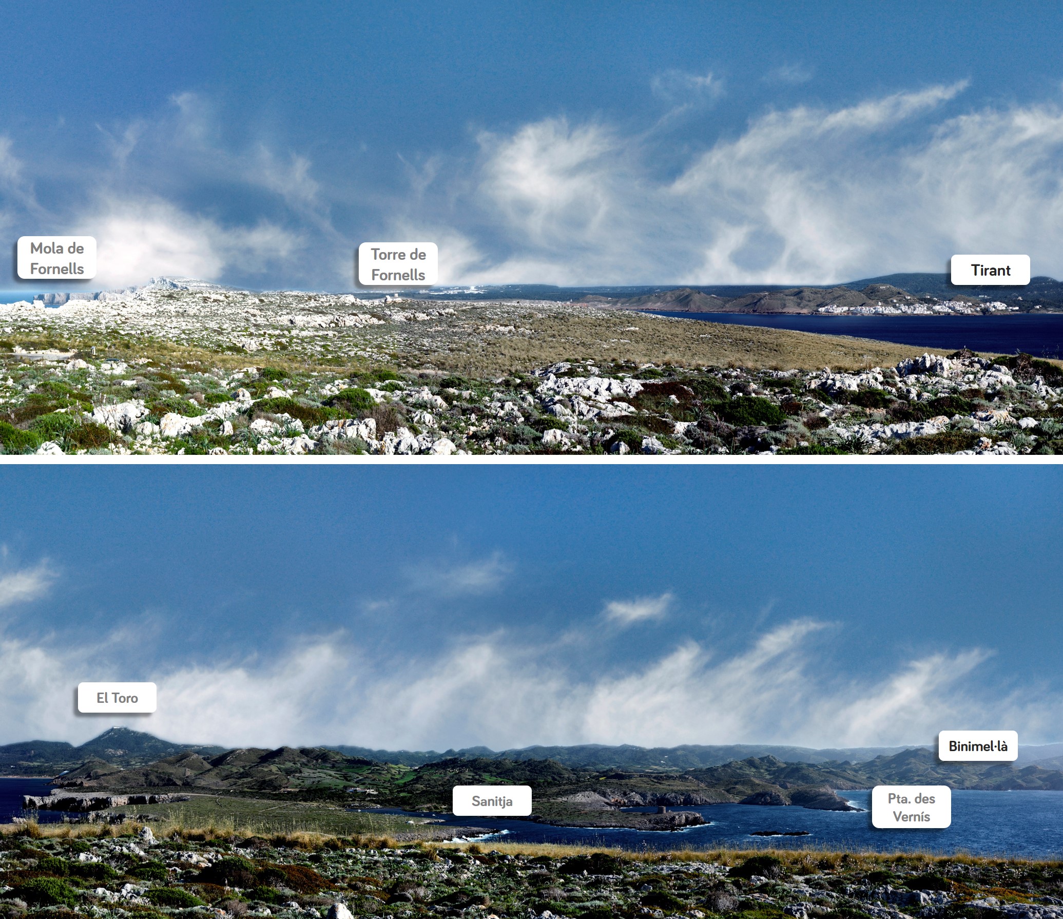
View from La Mola de Fornells to Binimel•là from Cap de Cavalleria. In the foreground, the relief is flat; by contrast, small hills dominate the background.
The former are the grey rocks formed some 180 million years ago in a calm, shallow sea, while the latter are the oldest rocks discovered in the Balearic Islands, formed some 400 million years ago, also in the sea, but at a great depth. So, if there are big differences between these two sets of rocks, how is it possible to find them next to each other?
You have to find the answer in the action of a fault. Millions of years ago, huge tectonic forces, that were able to cause enormous earthquakes, caused the grey rocks to sink in comparison with the dark rocks, which in turn rose or remained immobile.
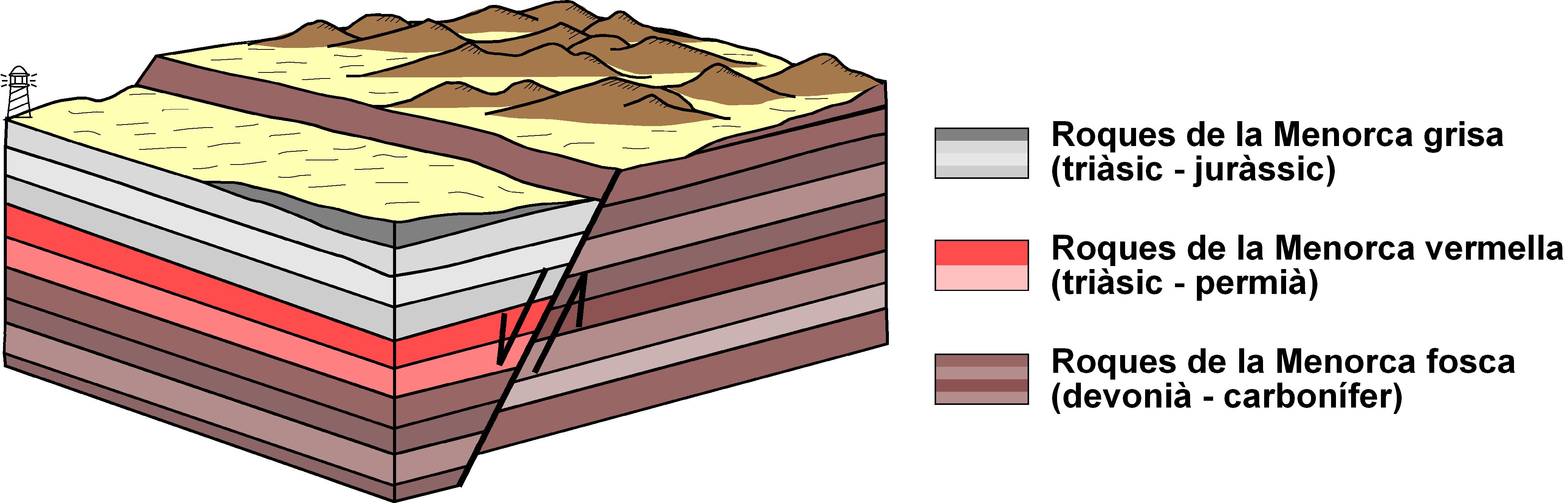
The sinking of Cap de Cavalleria (which, years earlier, formed a continuous land with the Cap i Mola de Fornells and Sanitja – Punta des Vernís), placed its rocks at the same height as those of Tirant, sedimented many millions of years earlier.
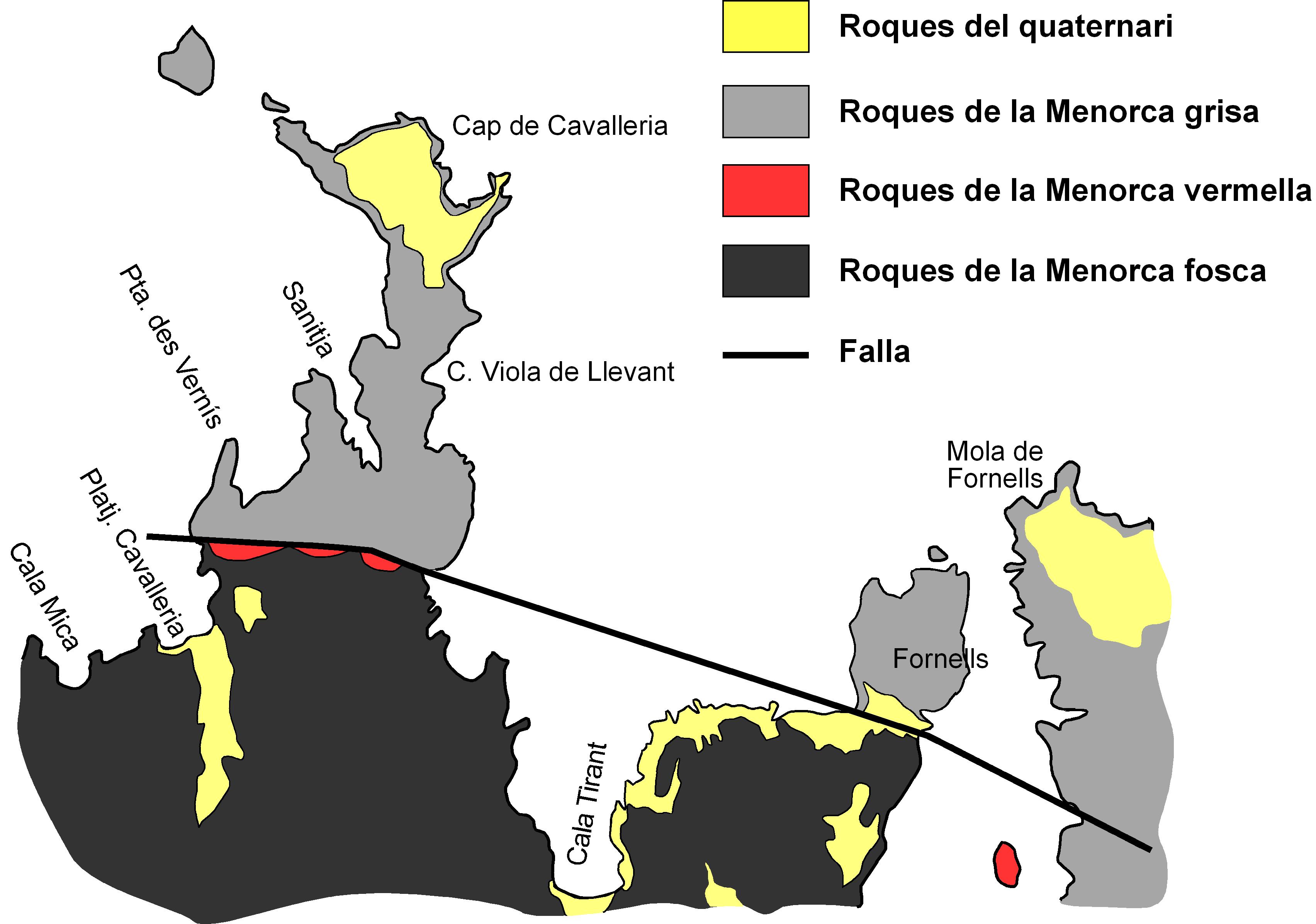
A more or less straight line is drawn on a map of this fault that follows the path demarcated by the sunken block of Tramuntana formed by the Mola (mesa) and Cap (headland) de Fornells, Cavalleria and Sa Nitja – Punta des Vernís, which were once joined together.
In the background, the El Toro mountain, made up of the same grey rocks, lead us to believe that perhaps at some time Cavalleria and El Toro were at the same height and that a series of staggered faults sank Cavalleria by at least 340 metres compared with El Toro.