| UTM-X | UTM-Y | ||
|---|---|---|---|
| STOP 1: THE KARSTIC CANYON OF THE TORRENT DE PAREIS | |||
| STOP 2: THE VOLCANIC ROCKS OF CALA TUENT | |||
| STOP 3: THE LANDSLIDES OF SA COSTERA | |||
| STOP 4: SPRING OF SA FONT DES VERGER |

Recommended route.
Although karstic canyons are relatively common structures in Mallorca, especially in the Serra de Tramuntana, the Torrent de Pareis has dimensions that surpass all the others because it derives from the union of two important watercourses: the Torrent del Gorg Blau, coming from the southwest, and the Torrent de Lluc coming from the east.
While the stream runs between vertical walls several dozen metres high in most of its course, in the zone of the canyon mouth, popularly named S’Olla (“the saucepan”), the terrain widens notably to form a large flat-bottomed valley surrounded by vertical walls which give it its name.
The walls display an abundance of cavities (as at point A), and locally channelled forms in the surface of the rock, the result of dissolution by meteoric water. The collection of forms of dissolution appearing in the rock surface is named karren.
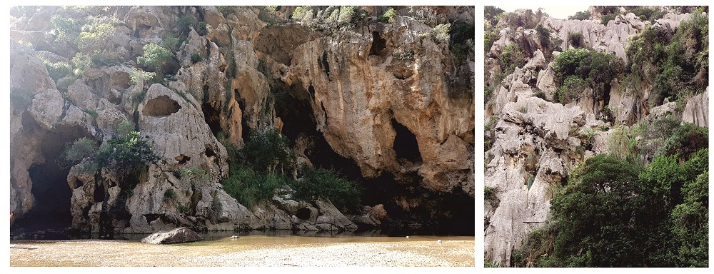
Abundant karstic cavities (left) and lapies (right) in the walls of S’Olla.
At this point, the ground is formed by pebbles transported along the watercourse which finally accumulate in S’Olla because the widening of the stream causes a reduction of the energy of the water.
Approaching the coast, the walls narrow again. It is at this point (point B) where the stream ends at a barrier of pebbles (called a codolar) which usually separates the stream from the sea. However, after periods of heavy rain the flow reactivates and breaks through the barrier to enter the sea.
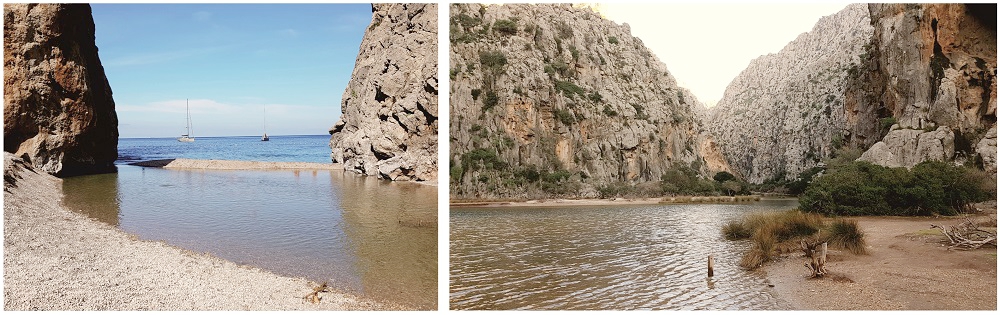
Detail of the zone of the canyon mouth, with the pebble barrier (left), and appearance of S’Olla in winter.
Finally, it can be commented that in the past the entrance to S’Olla was by way of a crack in the mountain, but nowadays it is by way of tunnels excavated in the rock which also take advantage in a part of the route of cavities developed in the fractures of the rock. Inside them we will be able to see typical speleothems of caves, such as stalactites and flows.
Associated with these fractures there appear deposits of breccias of the Upper Pleistocene (Quaternary) which constitute a notable paleontological site.
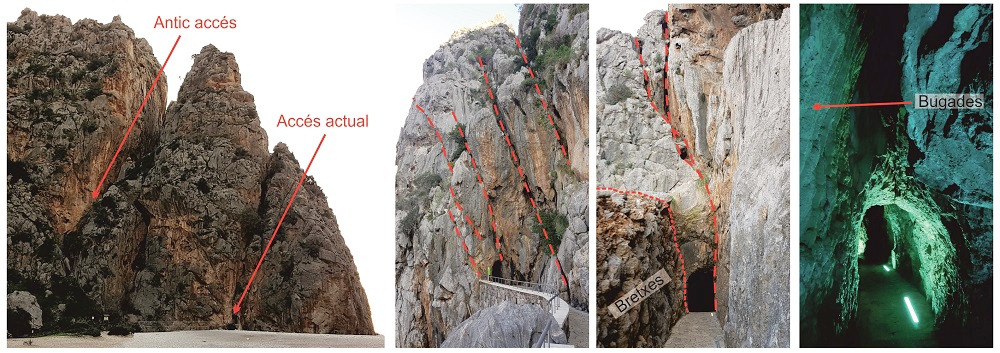
Fractures of the rock used to enter S’Olla (left), detail of the fissures (centre) and of the speleothems (right).
On the way to Cala Tuent and just before reaching the turnoff, it is recommended to look east, towards the road that continues to Lluc. In the distance we can see a good example of an instability process that takes place in this zone of the coast: the lateral expansion, which occurs when the limestones and breccias of the Lower Jurassic slide over the clayey materials of the Upper Triassic.
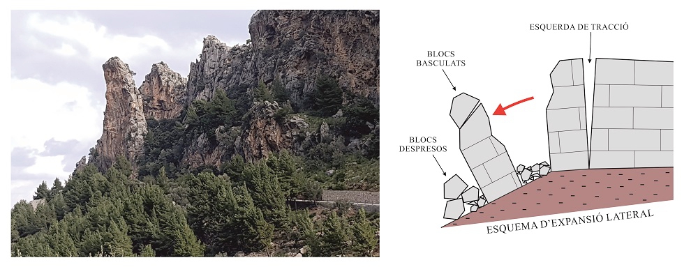
Process of lateral expansion.