On the eastern coast of the Cala Pi residencial area, at sa Dent point, there is one of the most remarkable outcrops of the Pliocene (5.3-2.5 Ma).
This is an ancient quarry which, according to the sources consulted, may have a prehistoric, roman or andalusian origin.
The material exploited in the quarry is a type of Sedimentary rock whose main component is calcium carbonate (CaCO3). Its origin can be chemical, organic or detritic.</p><p><br></p></div>">limestone rock called lumaquela (acopinyat in Mallorcan speech), formed by the accumulation of mollusc shells. In the case of the quarry of Cala Pi, the shells are not complete but the lumaquela is formed by countless small-sized fragments.
Due to the abrasive characteristic of the rock, the quarry was used to make millstones.
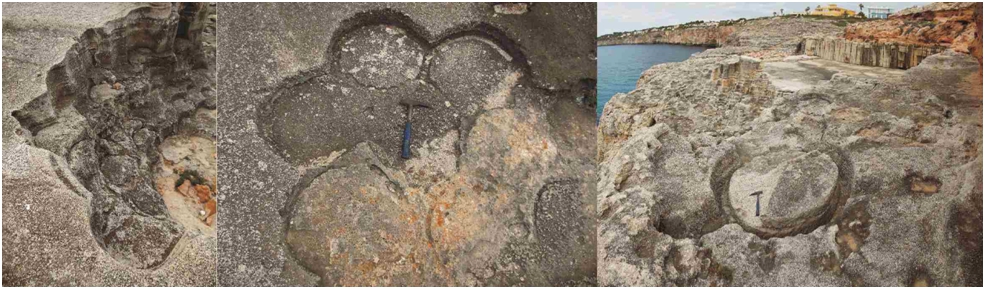
Moulds of millstones.
In recent times, the quarry has been used to extract construction blocks which have been used in several homes in S’Arenal.
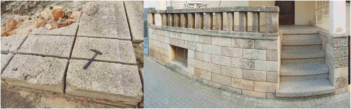
Detail of blocks of lumaquela existing in the quarry and in a home in S’Arenal.
Approaching the cliff edge, we can observe that underneath the whitish lumaquela there appear grey-coloured rocks, sandy limestones with an abundance of molluscs. They correspond to reef-origin limestones of the Upper Miocene and have been formed in the shallow, peaceful lagoon zone lying behind the reef core.
The reef limestones appear deeply pitted and intensely altered, which indicates that the contact between the lumaquela and the limestones is of the erosive type. It is very probable that this erosion is related with a catastrophic event named the Messinian Salinity Crisis (around approximately 6.0 Ma) in which the Mediterranean partially evaporated and left the reef limestones exposed above the sea level.
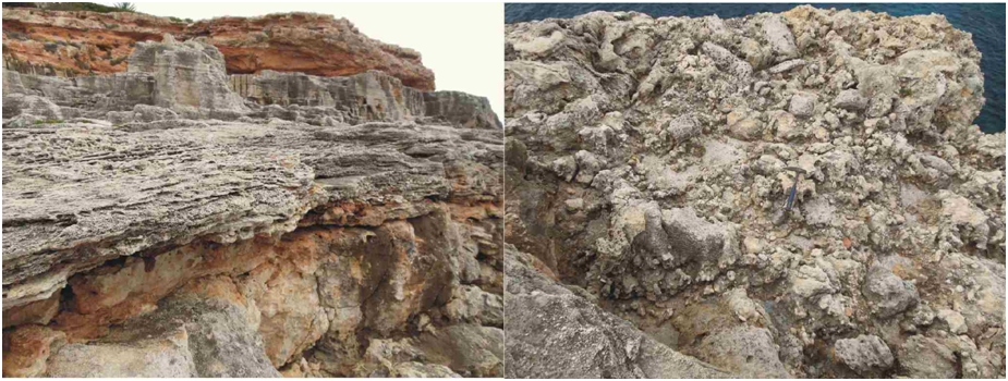
Contact between the lumaquela of the Pliocene and the reef limestones (left) and appearance of the limestones (right)
The lumaquela corresponds to a beach deposit formed in the Pliocene (a period lasting from 5.3 to 2.5 Ma), coinciding with the re-flooding of the Mediterranean.
The first thing observed just above the reef is a finely laminated rock with small-scale cross-stratification and structures related with the activity of living organisms (bioturbation), which have been interpreted as deposits of a sublittoral zone or shoreface (the zone of the shore located between low tide and the base level of the waves).
Detail of the sediments of the sublittoral zone, showing cross-stratification and vertical bioturbations.
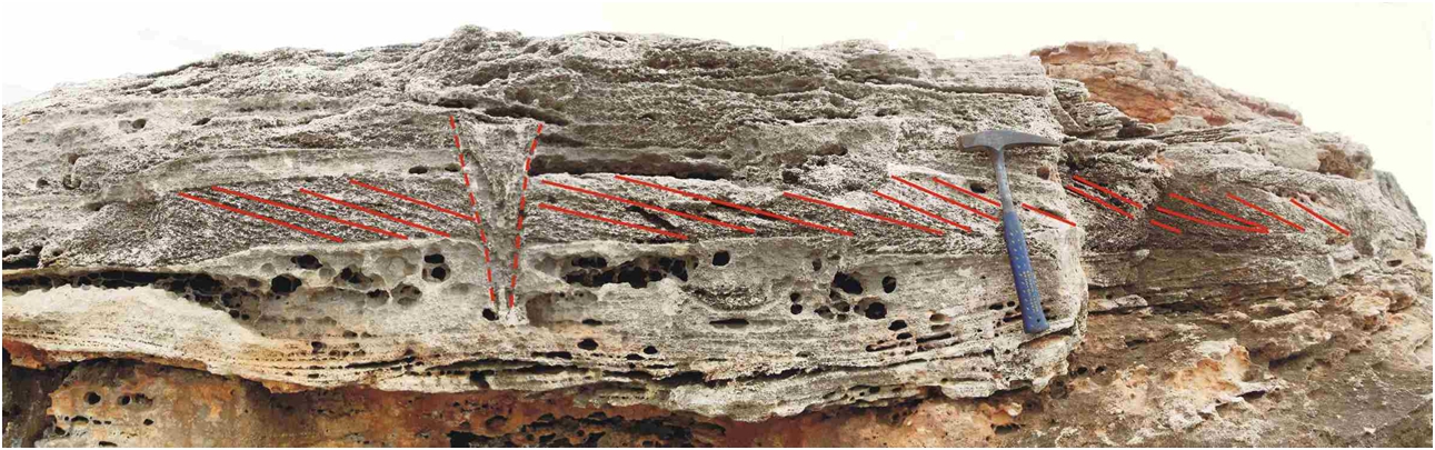
Above this, constituting the largest part of the tectonic, eustatic or antropical processes</span></p></div>">outcrop, there appears the lumaquela, displaying a certain low-angle stratification which has been interpreted as a deposit originating in the wave beating zone or foreshore (between low and high tide). It is even possible to distin-guish the crest zone in one of the walls of the quarry.
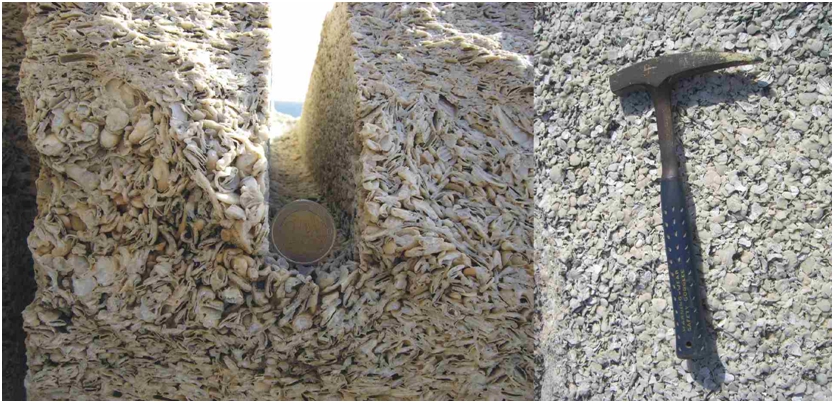
Detail of the lumaquelas of the quarry.
As we leave the clifftop and walk inland, the strata become more horizontal, which indicates a lesser influence of the sea. This is the beach zone named backshore.
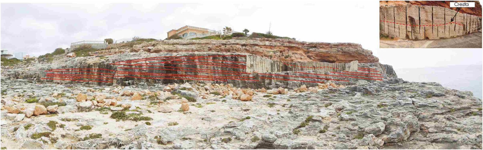
General view of the quarry, marking the stratification and a detail of the crest zone.
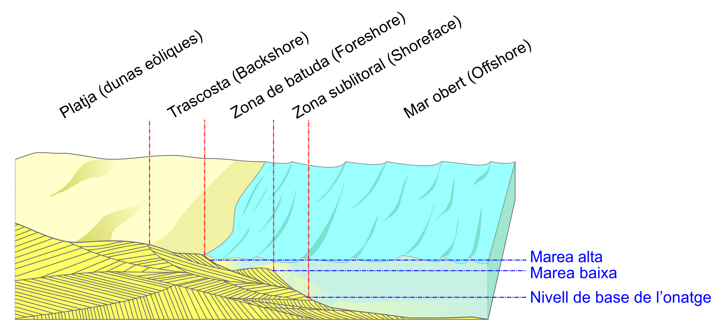
Zones found on a beach (modified from Arche, 1992).
The entire area is covered by parallel-plane strata of reddish colour which correspond to ancient soils and dunes of continental origin, mainly developed during the Pleistocene (2.5 Ma-10,000 years).
There is an alternation of silts and calcarenites (marès). The calcarenites display cross-stratification, the result of the different directions of the wind that carried the sand, and rhizocretions, moulds of the roots of the plants that live on the dunes.
The differences in hardness between the silts and the calcarenites have led to the differential erosion of the strata.
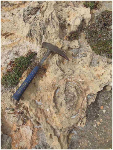
Rhizocretions on Pliocene deposits.