The Escorca viewpoint offers views of two areas of geological interest: the karstic landscape of the S’Entreforc zone (Torrent de Pareis) and the tectonic structure of the Puig Roig.
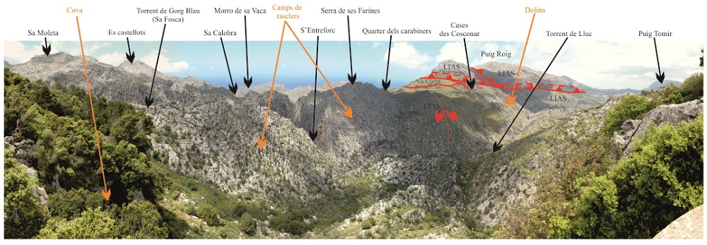
Panorama from the viewpoint.
Starting from the left, the first feature that calls our attention is the Puig de Sa Moleta and its table shape. This is due to the fact that the materials that form it are well-stratified limestones in thin layers, which correspond to the Sóller Formation, from the Lias (Lower Jurassic, 200 Ma).
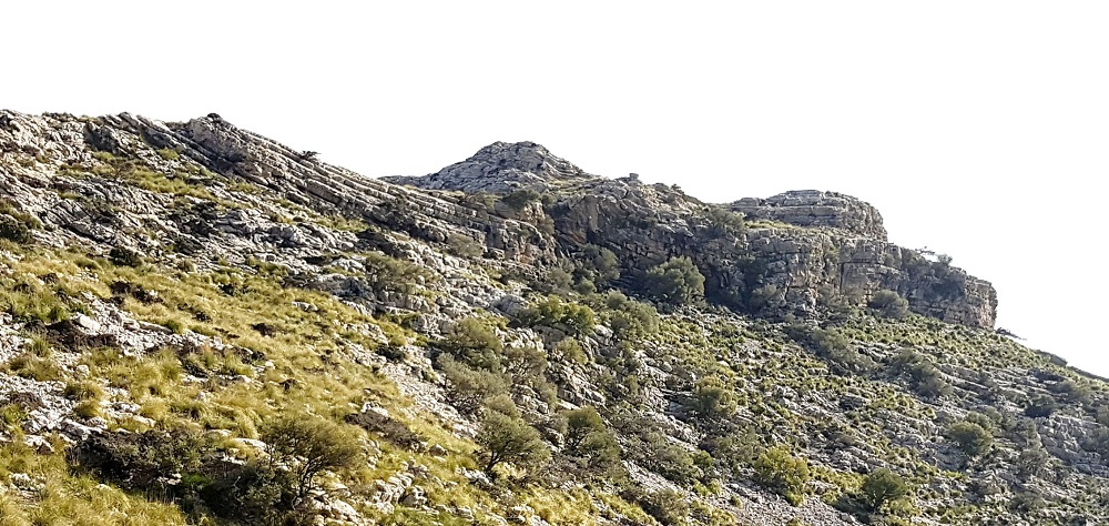
Detail of the limestones of the Sóller Formation of the Puig de Sa Moleta, from Es Coll des Rei.
If we observe the wood close to the viewpoint, to the left we can intuit the entrance of a karstic cavity, which developed in the same rock that supporting the viewpoint. Iin the distance we can see the peaks of Es Castellots, which are dome-shaped due to being massive limestones.
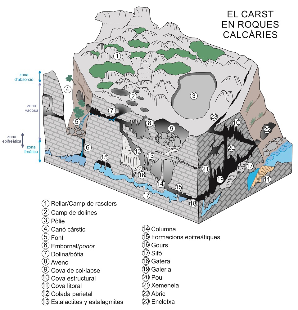
Turning our view towards the right, we begin to see an abrupt, rugged, rocky landscape that is difficult to walk on: this is a typical karstic landscape, with karren, dolines, chasms, caves and canyons.
A surprising feature is the gorge of the S’Entreforc zone which cuts perpendicularly through the Jurassic Sedimentary rock whose main component is calcium carbonate (CaCO3). Its origin can be chemical, organic or detritic.</p><p><br></p></div>">limestone strata. It is in this zone that the Torrent de Lluc and the Torrent des Gorg Blau converge to form the Torrent de Pareis, which comes out in the zone of Sa Calobra.
Both the Torrent de Pareis and the Torrent des Gorg Blau are true karstic canyons with vertical walls hundred of metres in height. In the case of the Gorg Blau, the walls are so close that there is a dark section known precisely as Sa Fosca, “the dark.”
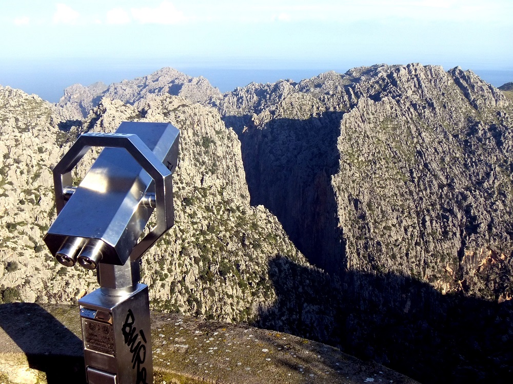
Gorge of the S’Entreforc zone.
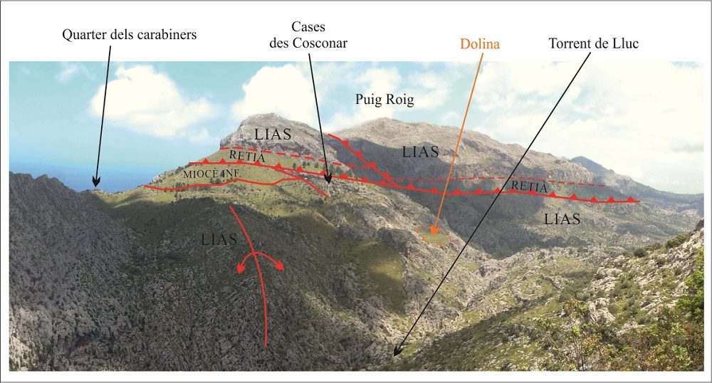
Further right we see another peak, the Puig Roig, which is so named because its rocks seem to be stained red in contrast with those of the rest of the zone, which are grey.
Geologically, the Puig Roig corresponds to a structure called a tectonic Tectonic outcrop in the form of an isolated topographic elevation caused by the erosion of one or more thrust fault strata. The result is an outcrop of allochthonous material surrounded by autochthonous material, also named a tectonic island.</p></div>">klippe. A Tectonic outcrop in the form of an isolated topographic elevation caused by the erosion of one or more thrust fault strata. The result is an outcrop of allochthonous material surrounded by autochthonous material, also named a tectonic island.</p></div>">klippe is formed when a mass of rock is superimposed over another by a fault
<div class="ql-editor"><p class="ql-align-justify">Inverse fault in which the stratification plane.</p><p><br></p></div>">dip of the fault plane is at a low angle (generally less than 45<sup> o</sup>). It tends to refer to large-scale (regional) structures.</p><p><br></p></div>">thrust fault and is later eroded, leaving a vestige isolated from the rest.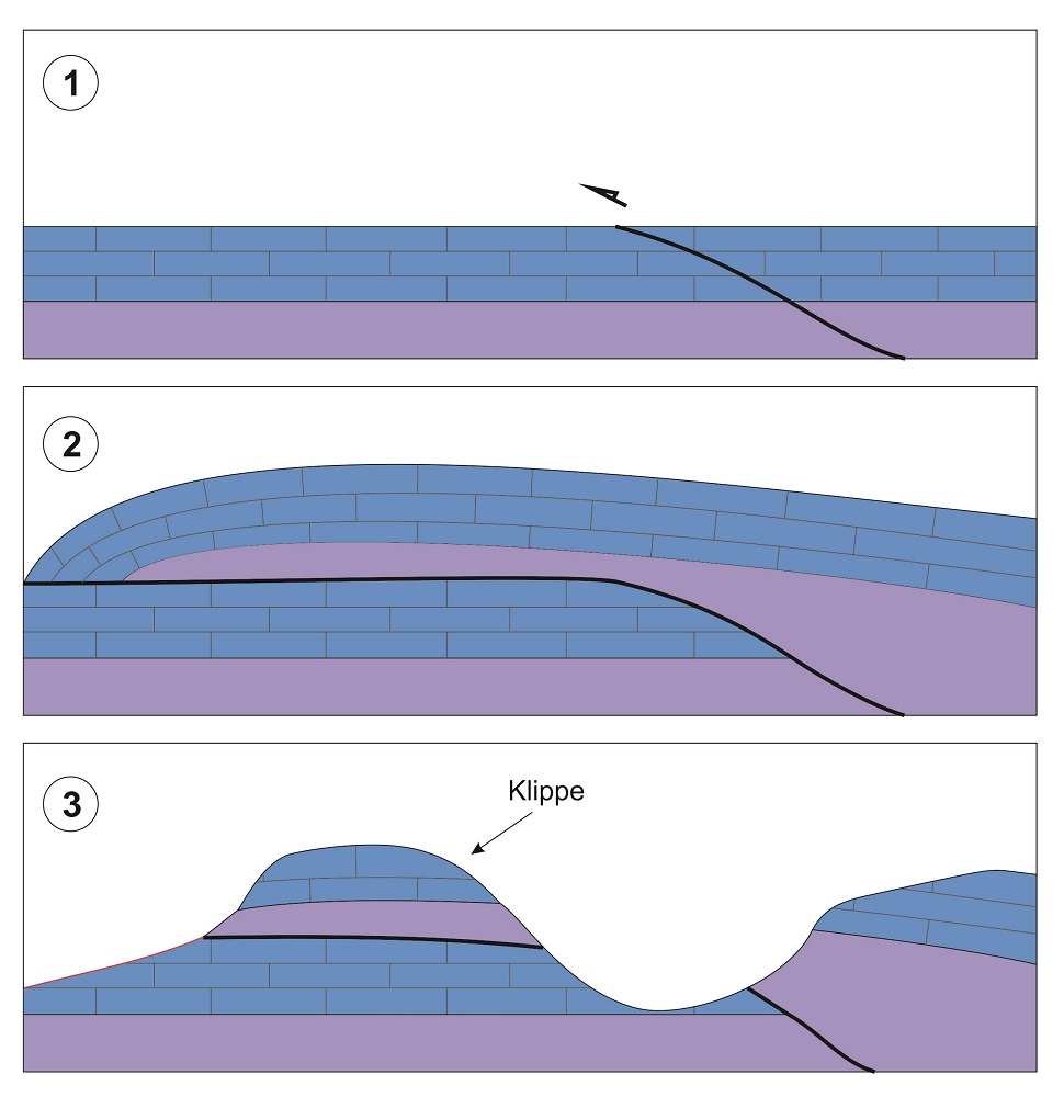
Simplified diagram of the formation of a tectonic klippe.
Detail of the tectonic klippe of the Puig Roig from the viewpoint.
Finally, the conglomerates we can see in the vicinity of the viewpoint and alongside one of the car parks correspond to a unit of the Upper Oligocene (Tertiary, 30 Ma ago), also affected by the thrust faults which were generated during the Alpine Orogeny, which began 25 Ma ago. These conglomerates are formed by pebbles of very diverse origins where some collide with others and dissolve them: these are known as traces of pressure-dissolution.