The Puig de Randa, at 540 metres, is the highest peak of the Central Ranges, a series of generally low hills located between the Llevant and Tramuntana mountain ranges.
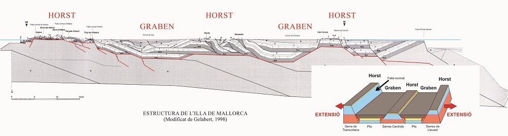
Since the Upper Miocene (11.6 Ma ago) the island of Mallorca has been separated from the Iberian Peninsula and displays a tectonic structure of raised zones (horst) and depressed zones (graben). The Puig de Randa constitutes a central horst, which makes it an excellent place for viewing the structure of the island.
There are two viewpoints where the island’s tectonic structure can be observed in all its splendour: one in the vicinity of the Morro d’en Molt and the other on the rear terrace of the Santuari de Cura.
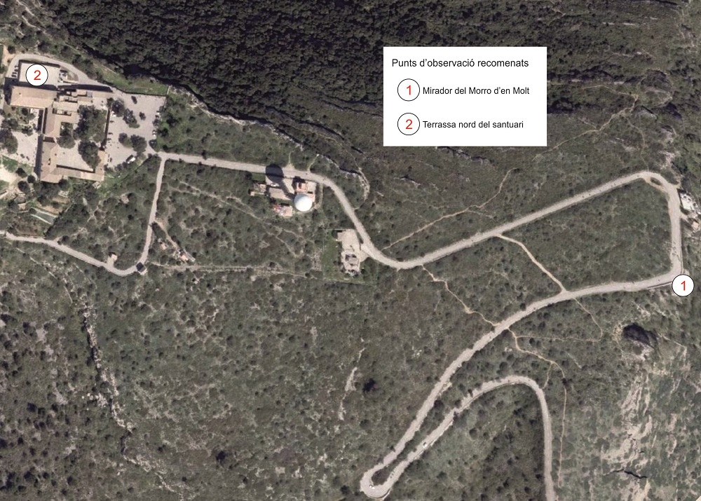
Recommended viewpoints
From the Morro d’en Molt we see in the distance the Serres de Llevant, which constitute a horst, and some of the hills of the Serres Centrals such as the Puig de Monti-sion, overlooking the town of Porreres, and the Campos Basin, which is a graben. On clear days it is possible to make out the Cabrera archipelago, which geologically constitutes a prolongation of the Serres de Llevant.
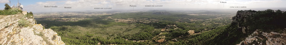
Panoramic view from the Morro d’en Molt
From the upper terrace of the sanctuary we can see to the north-west the Serra de Tramuntana. This is Mallorca’s largest horst, and it includes the island’s highest peaks, with the Puig Major at 1,445 m.
The graben located between Randa and the Tramuntana is composed of several isolated basins. From south to north we can see the Palma, Inca and Sa Pobla basins. This complex of basins and hill ranges is known as the Central Plain.
These basins were initially covered by the sea and the hill ranges constituted true independent islands, although over millions of years of sedimentation the basins have been filled in.
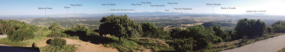
Panoramic view from the upper terrace of the sanctuary
Looking north-east we see another horst: the Serres de Llevant. Their origin is the same as that of the Serra de Tramuntana, although they began to form a few million years earlier.